Friday, November 2, 2012

California, Sonoma Wine Country

After our son left home to seek his fortune in the Silicon Valley we missed him.  So we used the opportunity of his first half-marathon to visit him at his hacker house in Palo Alto.  The race was a lot of fun and we met all of his house mates who turned out to support him at the race.


And of course, I used the opportunity to get in a bike ride.  Mona and I rented a Zip car parked across the street from our San Francisco hotel and drove north to Sonoma, CA. 

Golden Gate Bridge

Shops of Sonoma, CA
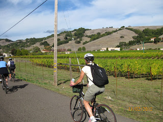
The bike tour left from downtown Sonoma which has is nice destination itself with interesting shops and a town square.  The biking was easy wandering the back roads of Sonoma.  On the way we visited several vineyards stopping for wine tasting.  It's a little weird to be sipping a Cabernet at 10 am in the morning and it will go straight to your head.  But a brisk pedal stroke will clear your head in time for the next vineyard.
  
Hydrating or cleansing our palates?

Founded by an SIU graduate

The Homewood Winery was founded by a SIU graduate.  They had a special offer for a blended red named after his college intramural basketball team, "The Flying Wizzbangers."  We bought a case.
I'll take a case of Flying Wizzbanger, thanks.

Wine! Biking! Whee!


The perfect spot for lunch!


When our tour guide informed us we were ahead of schedule, I conferred with the other riders.  "Since we have extra time, let's add this loop on Lovall Valley Road."  The guide later referred to her "trip getting hijacked," but she was a good sport.  Lovall Valley Road was the nicest riding of the day.

Extra loop around the Lovall Valley


While its nice to be led by a guide, you can easily tour these wineries on your own.


On the way back to the city, we stopped to admire the huge coastal Redwoods.


John Muir Woods

State:California
Date:2012-11-02
Route:Sonoma Winery Loop plus side trip to the Lovall Valley
Distance:20 miles

Saturday, August 18, 2012

Missouri, Katy Trail

I used the excuse of dropping off my daughter at U of I as an opportunity for a Missouri bike ride.  The Katy Trail, named after the Missouri, Kansas and Texas Railway, runs over 200 miles from just outside St. Louis to Machens, MO.

Following the Missouri river, the Katy Trail features B&B's, wineries, trail-side restaurants and quaint towns.  Today I rode from the tunnel just west of Rocheport to Hartsburg.


The Katy trail features numerous access points along the route.


Tunnel near Rocheport

Missouri River


This summer's drought left the corn fields brown

View from Eagle Bluffs Overlook Trail


Very bad season for corn

A stone the shape of a shark's tooth flattened my tire.
End of the day
(Add story about wood-fired pizza)


-- Frizbo


State: Missouri
Date: 2012-08-18
Route: Katy Trail
Distance: 53 miles

Wednesday, May 23, 2012

Nevada, River Mountains Loop Trail, Hoover Dam and the Grand Canyon

When my son, Matt, graduated from college, I proposed a father-son backpacking trip to the Grand Canyon which he readily accepted.  We flew into Las Vegas and on the way to the canyon we stopped for a bike ride -- and what better way to acclimate to the desert climate than a bike ride.

Boulder City, NV is just south of Las Vegas and has easy access to the River Mountains Loop Trail which runs through the hills and along Lake Mead.


Trail head

Matt surveying our route
Off the main loop, a spur trail runs to Hoover Dam along the old right-of-way the railway used to move materials to the dam during construction.

Power infrastructure for the Hoover Dam generators
Just above the Visitor's Center is a bike rack where we locked up our rental bikes and walked down to the dam.

Angel Statues

Hoover Dam intake towers

Hoover Dam spur trail tunnel

Feels pretty hot here for Midwestern boys

Grand Canyon South Rim (the "before" picture)

Our backpacking itinerary was the classic "Rim-to-Rim" route.  It started with a 5-hour shuttle from the south rim to the north rim.  From there we would descend to camp at the Cottonwood Campground.  Then down to the Bright Angel Campground/Phantom Ranch for two nights at the bottom of the canyon.  One day up to Indian Garden and then climb out of the canyon on the last day.  

We arrived at the north rim to find the ranger station closed for the night.  I had understood that backpackers with a permit didn't need reservations for the first night at the north rim campground, but now I had no idea where to camp.  Fortunately, a another pair of backpackers had sympathy on us and allowed us to share their campsite.  It turned out they were also father and son, also celebrating the son's recent graduation from a Big Ten school (Wisconsin), and also an engineering major.
Grand Canyon North Rim

North Kaibab Trail

Interestingly, the park's South Rim is supplied with water by an antiquated and leaky pipeline that runs from the North Rim down to the canyon bottom and up the other side.  The pipeline breaks often enough that backpackers are cautioned to bring a water filter.  At the Cottonwood Campground, we learned the pipeline had burst and there was no water.  I had followed the park's recommendation, but not everyone was as prepared.  We watched a rim-to-rim runner scaling the canyon wall by Roaring Springs with his water bottle to fill up with the cleanest water possible. 


Words of wisdom
Later we saw the source of the problem, a water geyser gushing 50-feet in the air from the partially buried pipeline along the river.  Apparently, turning water off at the below-the-rim campgrounds maintains enough pressure to provide water to the South Rim's six million annual visitors.  Another fun fact: the heaviest-use restrooms at the South Rim go through more than a mile of toilet paper each day.


That's not a suntan, it's a dust tan

Ribbon Falls, North Kaibab Trail
On day two, we were passed a group of backpackers sporting ultralight backpacks.  I don't understand why, but ultralight backpackers can't hide their sense of superiority.  "Those are mighty big backpacks you got there," one cracked as he walked by.

"You're just jealous," I retorted.  "Of my big package!" I should have added.  My response must of prickled because he sneered at me when we passed them on the trail later on.  Really, you're giving me a hard time because I packed too much?  This encounter was the genesis for an article I would later write for the Sierra Club (Hoarder, Foodie, Loose Cannon -- Which Backpacker Are You?).

Bark scorpions glow bright green under a UV light!  Really
Matt and I feasted on a steak dinner at the Phantom Ranch.

After dinner we joined the ranger in a scorpion hunt.  The ranger produced handheld black light and scanned the rock posts by the mule corral.  The scorpions hangout at the corral because their prey eats mule dug.  Sure enough, hiding in the various nooks and crannies were scorpions glowing bright green in the shine of the black light -- amazing.  

Tonto Platform, Clear Creek Trail

115 degrees!

Grand Canyon South Rim (the "after" picture)


-- Frizbo

State: Nevada
Date: 2012-05-23
Route: River Mountains Loop Trail
Distance: 20 miles