Thursday, March 31, 2016

Florida, Fort Pickens National Seashore

Spring Break Road Trip -- Days 3-5

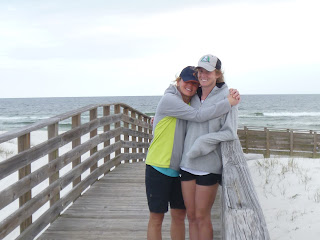
After a long drive through the Mississippi darkness, we stayed in Foley, AL and in the morning headed for the beach at Gulf Shores State Park.  Only Yankees fleeing winter would think it was a good day for the beach.

Yankees at the beach

Floating on the quiet waters of English Navy Cove
While strolling on the beach we discovered a frog in the surf.  Apparently, the poor guy accidentally let himself get washed out to sea from the nearby pond and creek.  Lauren immediately resuscitated him in a water bottle ("Hey, I was going to drink that").  We then walked across to road to the pond and released him into frog friendliest spot we could find. 

Frog rescue

He's so happy to be back in fresh water!
After the rescue, the magic frog (well, he claimed he was magic) granted us one wish.  We couldn't agree until Mom said, "I wish you would stop arguing."


For the main event, we packed a lunch and biked to Fort Pickens from the hotel parking lot.  The national seashore road is quiet and nicely paved, but has no shoulders.

Which way?
After ten miles, the road dead ends into Fort Pickens -- a fortification built after the War of 1812.  As we rode to the Visitor Center, I was distracted by the sights and sounds and failed to notice a speed bump.  I hit it going slow and one-handed.  Bam, I went over the handler bars and onto the pavement.  It must have been quite a sight as two fishermen rushed over to help.

Fort Pickens National Seashore

The old fort
Except for some minor scrapes on my knees and pride, I was OK.

Pensacola Beach Surf


We had a few nice days of beach weather, but the next day's forecast was terrible with heavy rains and wind.  So we decided to leave a day early to get a head start on the drive home. 
Route: from the hotel to the fort
Plus Georgia is not that far out of the way, is it?


State:Florida
Date:2016-03-31
Route:Hampton Inn Pensacola Beach to Fort Pickens
Distance:20 miles

Monday, March 28, 2016

Alabama / Mississippi, Natchez Trace Parkway

Spring Break Road Trip -- Day 2

The Natchez Trace Parkway, a 444-mile scenic road, follows the route of ancient game migrations and the Native Americans that hunted them.  Later the trace was used by early traders returning north after selling their goods and flatboats in New Orleans.   Bypassed by steamboats and railroads, the route lay dormant until developed as a National Parkway by the CCC in the 1930s. 

Tishomingo State Park

We start our ride in Tishomingo State Park which conveniently abuts the the parkway.  The park ranger suggested we park next to the ramp that leads to the Trace, but we parked at the far end of the state park so we could enjoy the  state park's roads too.


From Tishomingo, we head north to Alabama.  The sky is clear, the sun warm with a light breeze -- nice! 

Lauren (way ahead) riding the De Rosa on the Trace
This winter, Lauren bought a used triathlon bike at the local bike swap.  A stunningly beautiful conveyance, it was love at first sight.  Based on the frame size and the assurances of the seller, we thought the bike would fit.  Only later did Lauren realize the seat and aerobars could not be adjusted to fit her.  After several attempts, a second bike shop and some additional hardware Lauren finally has a BIKE TO RIDE!  And ride she did, leaving Mom and me in the dust.

Two states, Mississippi and Alabama, in one day

Napping after lunch at Freedom Hill Lookout


State park's rustic cabins
Route: Tishomingo to Freedom Hill Lookout

I managed to book one of Tishomingo State Park's very popular rustic cabins at which I envisioned a nice cookout and campfire after our ride.  But when the girls saw the nice beach forecast for the next day, they had other ideas.  So after a quick dinner, we were back in the car driving south into the Mississippi night.

State:Alabama, Mississippi
Date:2016-03-27
Route:Natchez Trace Parkway: Tishomingo State Park, Pavilion #1 to Freedom Hill Lookout
Distance:31 miles

Sunday, March 27, 2016

Kentucky, Land Between the Lakes

Spring Break Road Trip -- Day 1

I'm not sure who's idea it was for a Spring Break trip, but Lauren was home preparing for grad school and there was some backroom lobbying for a road trip to Florida.  I wasn't too keen on the idea at first as I was expected to do all the planning and most of the driving.  But once the itinerary included biking in multiple states, I became a major sponsor of the proposal. 

Feeling the sun after a long Chicago winter
There is something quite uplifting driving from Chicago to Florida in the Spring.  As you leave Chicago, it's still cold with some remnants of snow under bushes and in the corners of parking lots.  But with each stop, the signs of Spring gradually begin to appear.  At the gas station, you feel a hint of warm breeze. After lunch you realize you don't need gloves anymore.  In the late afternoon, the sun is out and feels fantastic.  The accelerated transformation of Winter to Spring is magical.

Camel Rock, Garden of the Gods, Shawnee National Forest
We stop for some hiking in the Shawnee National Forest and then down to Cave in Rock State Park (worth a stop).  The park's namesake is a large natural cave used as a hiding place by pirates who preyed upon river travelers after the Revolutionary War until the 1830's.  Nearby is the Cave in Rock Car Ferry, which floats us to Kentucky.

Ohio River at Sunset from the Cave in Rock Ferry
In the morning, we drive to Land Between the Lakes (LBL) National Recreation Area.  LBL offers a variety of outdoor activities, boating, hiking, fishing, off-roading, camping... We here for some biking and the biking is really nice. 

Quiet forest road in LBL NRA
The NRA is threaded with quiet forest roads, many of which are paved.  The main north-south road is "The Trace" and while a little busy is flatter than the forest roads.  The east-west thoroughfare, US68, is the busiest road, but there is a separate bike path that runs part of the way and we rode the wide shoulder the rest of the way.  


Some decent climbs

Our route
LBL is definitely bike friendly and there are plenty of biking options.

Back at the van

Next stop Corinth, Mississippi!


State:Kentucky
Date:2016-03-27
Route:Land Between the Lakes, Silver Trail Road, FR 134, R 68, The Trace Road
Distance:26 miles