Tuesday, September 29, 2020

Texas, Palo Duro State Park

New Mexico Tour, Day 4

Palo Duro State Park is a mountain biking mecca and the site of the USA Cycling  mountain bike national championships.  Similar to Caprock Canyons, Palo Duro Canyon lies just below the Caprock Escarpment and features miles of single track.  On my arrival, I hiked the Lighthouse Trail to get a lay of the land.  The trails looked really nice.

I was unable to reserve a campsite within the park, so I settled for the Canyon Rim RV Park just outside the entrance.  The RV park allows tent campers can set up anywhere on the grass.  I chose a spot with a nice view of the rim.  After dinner I took a shower in their ridiculous shower stalls.  The lighting was so poor I left the door ajar -- hey, when your my age you don't really care if anyone peeks in.  

Overlooking Palo Duro Canyon

On the canyon rim, the temperature got quite chilly in the wee hours.  Even wearing my long johns and a 20-degree bag, I was very cold.  

Turkeys looking for breakfast

In the morning, a thousand feet down from the rim, the weather was perfect for riding.  I started biking where I hiked the previous evening, the Lighthouse Trail.

This familiarity led me to be careless as I dropped down into a dry wash.  Instead of smooth transition, the trail dropped sharply causing me to hit the bottom leaning heavily on the front wheel.  On any of my other bikes, this would have resulted in a nasty crash -- an endo with a face plant.  But I was riding my new full-suspension Specialized Stump Jumper.  Bracing for the worst, I was surprised when the bike's suspension absorbed the poor landing with ease.  A quick couple of pedal strokes  and I was up the other side of the dry wash like nothing had happened.

Back in February, Mona had balked at the price of a new bike ($1,900 cash at the Chicagoland Bike Swap).  I probably just saved a couple thousand in medical bills by avoiding a crash so the bike just paid for itself.


Palo Duro State Park single track was spectacular.  It even has a trail for bikes only!  

"Share your thoughts"

"Once the trip starts, everything's bully" Richard Frisbie, RIP


Geology on the GSL Trail

My next destination was near Angel Fire, New Mexico where the elevation would be 9,000 ft., a mile higher than Texas.  Freezing on the canyon rim last night was on my mind, so I stopped in Amarillo and bought a big bulky rectangular sleeping bag to use as an extra layer.  Packed, the thing was the size of a beer keg, but only $19.  "I'm not sleeping cold tonight!"
  
Megalith near Cadillac Ranch

A few miles west of Amarillo is the famous roadside attraction, the Cadillac Ranch -- a sculpture consisting of ten Cadillacs buried nose-down in the ranchland.  The public are welcome and encouraged to add spray paint graffiti to the artwork.

Access to the ranch was off the frontage road and a little confusing.  As I approached, I suddenly convinced myself that I was actually driving the wrong way on the exit ramp to I-40.  I quickly pulled a 3-point turn and drove to the gas station to consult a map.  My panic was contagious as two women behind me with Wisconsin plates also turned around.

The confusion didn't end there.  After visiting the sculpture, as I drove west on the frontage road to the next I-40 entrance ramp, a large truck turned left into my lane and nearly drove into me head-on.  It was only my quick move to the shoulder that avoided a crash. 

New Mexico was only an hour away, but I was slightly apprehensive as New Mexico had closed it's borders to anyone without a recent negative COVID test.  At the time, tests were hard to come by, so I had mocked up a fake test result and hoped I wouldn't need to show it to the authorities.  I crossed the border without incident and headed north to Angel Fire and the Carson National Forest.


State: Texas
Date: 2020-09-28
Route:

Juniper/Riverside, Sunflower Trail, Rojo Grande, Lighthouse Trail, Little Fox Trail, GSL Trail,
Paseo del Rio Trail and back
Distance: 12 miles

Monday, September 28, 2020

Texas, Caprock Canyon State Park and Trailway

New Mexico Tour, Day 3-4

After driving across Oklahoma, I arrived at Texas' Caprock Canyons State Park and Trail just after 6pm with a reservation in the South Prong tent campground (#ST049).  The common parking wasn't ideal for sleeping in the van, but the park was strangely empty so it didn't matter.  Perhaps, the Texas Parks and Wildlife limited camping reservations due to COVID.       


South Prong Campground

Upper South Prong Trail

Before dinner, I hiked the the Upper South Prong Trail to the first outlook.  The red rock bluffs were quite beautiful.  As it got dark, the wind picked up.  Too cold to sit in the wind, I retreated into the van. 

"No water?  You should turn back"

Just imagine how many tries it took to get this selfie.

"Please close door when leaving ... So snakes do not come in"
(of course the door was open)

After breakfast I realized I needed to ride some of these trails before I left.  A quick out-and-back on the North Prong Spur trail gave me a sense on the park.  The trail's red dirt was well packed, but more of a jeep trail than single track.  Fun but I needed to get started on the main event -- The Caprock Canyon Trailway. 

North Prong Spur


Curious roadside sculpture -- Boots and Bikes?


Can You?

Megalith!

Stretching across western Texas is the Caprock Escarpment, geographical transition point between the high plains and the rolling terrain of eastern Texas.  The transition is a dramatic landscape of canyons, towers and sandstone bluffs.  

The Caprock Canyons Trailway starts below the escarpment and winds its way up to the high plains. The trailway is 64-mile multi-purpose trail following an railroad right-of-way featuring trestle bridges and 582-foot tunnel.  


Clarity Tunnel

Home to thousands of Mexican free-tailed bats

I didn't see any bats, but I did see plenty of guano!


I rode my cross bike based on the recommendation of the park ranger, but parks of the trail were very rocky and my mountain bike would have been a better choice.

Unintentionally chased this cow and calf for 15 minutes


The perfect spot for lunch


Route


After Caprock, I drove an easy 2 hours to Palo Duro State Park.

State: Texas
Date: 2020-09-28
Route: North Prong Spur, then Monks Crossing to the top of escarpment (within sight of first road)
Distance: 35 miles

Saturday, September 26, 2020

Arkansas, Bella Vista, Back 40 Trail

New Mexico Tour, Day 2

Another long day of driving, I arrived in Bella Vista, AR around 3pm.  Bella Vista is a recreational community with mountain lakes, large forested lots and some of the best mountain biking trails in the country.  I parked in the Bella Vista Community Church parking lot which abuts the Back 40 Trail and pedaled off.  The trail snakes its way between the roads and homes and through the woods and ravines.

Back 40 Trail!


Sweet!
The trail has plenty of climbs and descents and admittedly I had to hike-a-bike in a couple of places.  After biking three hours I had ridden just a small fraction of the mileage Bella Vista has to offer, but I needed to be in Oklahoma tonight.  Initially, I drove due west on state road, but the setting sun was directly in my eyes.  Barely able to see through the bug-covered windshield, I nearly hit some cyclists.  "OK, turn around, I'm taking the Interstate."

As it was Saturday night, I had reservations (#36) at a Army Corp of Engineers campground on Oologah Lake, OK.  I set up camp in the dark and wandered around the campground looking for the showers (my site was in the non-electric area).  The showers were quite nice and soon I was clean, dry and tucked inside the Family Truckster.

My latest improvements to the Trucksters' amenities included a screened cover for the back hatch.
  
New hatch screen

Fold-out table and kitchen
Window mosquito netting

Kickin' it in the Truckster

Egg, cheese and Canadian bacon on a bagel

Another big driving day, I left first thing.  Driving out of the campground I noticed a large spider in the highway.  "Wow, I need a closer look," I thought as I pulled over.  On the payment was a massive tarantula determined to cross the highway.  Apparently, male tarantulas migrate in the fall looking for mates. I saw several crossing this remote Oklahoma highway.

Oklahoma Brown Tarantula
Back 40 route

After a stop at Foss State Park for lunch (unremarkable), I arrived at Caprock Canyons State Park, Texas.

State: Arkansas
Date: 2020-09-26
Route: Back 40 Trail loop starting at Bella Vista Community Church with a shortcut on Muligan and Rago trails
Distance: 18 miles

Friday, September 25, 2020

Missouri, Berryman/Ozark Trail

New Mexico Tour, Day 1

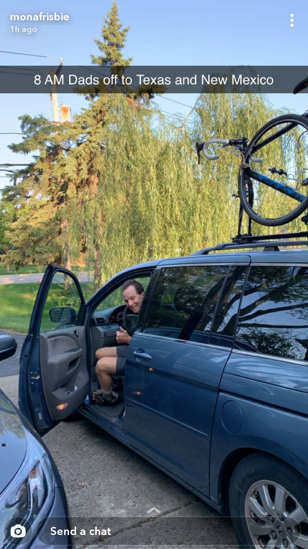
Earlier in the year, a 60th-birthday trip to Albuquerque, NM with my family was cancelled due to COVID.  With the start of fall, I was desperate for an adventure and New Mexico was still on my mind.  With a 8-day itinerary to New Mexico, I left Mount Prospect at 8:05 am.  

Two bikes and a mini-van!

I arrived in Missouri at 3pm at the Berryman Campground in the Mark Twain National Forest.  The small campground has only 8 sites, vault toilets and no water.  The camp sites are first-come-first-serve and free.  As I arrived early on a Friday, I had my choice of sites.  A few hours later, all the sites were full.  

With only a few hours until sunset, I didn't have time to ride the 27-mile Berryman Loop.  Instead I headed south on the Ozark Trail as an out-and-back to be sure that I'd be back before dark.

Berryman Loop/Ozark Trail

Berryman Loop/Ozark Trail

The Ozark Trail is a 230-mile backpacking trail running through the Missouri's Ozark mountains and most of it is open for mountain biking.

The trail started right from the campground.  I felt a little stiff after the long drive, but it didn't take long to loosen up on this really nice single track.  It also didn't take long to collect more than a few spider webs.  How a spider manages to rig a web across a trail is really a miracle.  Do they swing from branch to branch or wait for a breeze to blow them across the gap?  And they do it quickly too.  On my return leg, I gathered almost as many webs as the outward leg.  I only had time for a taste of this trail.  I'll have to come back and ride the entire Berryman Loop.  

Back at the campsite, I set up camp, collected firewood and cooked dinner.  As the autumn evenings can be long, I brought my guitar to entertain myself (and hopefully not annoy anyone else).  Just as I started to strum, something bumped my foot.  Looking down, I discovered a Copperhead out looking for dinner in the early dusk.  He seemed unbothered by my guitar playing and stopped long enough to pose for some pictures.    

Aww, a Copperhead welcomes me to Missouri

The Copperhead bite is painful but rarely fatal.

I followed the snake around my campsite until he slithered off into the bushes.  I resumed my guitar playing until again I felt something on my boot.  This time it was a walkingstick.  WTF, is it my guitar playing or maybe I should light the fire?


Northern Walkingstick

Once I lit the fire, I didn't have any more visitors in my campsite.  I did hear a fair amount of commotion coming from the picnic area -- loud voices, car engines.  When I left the next morning, I noticed many more folks had set up camp in the picnic area.  Usually camping in a day-use areas is discouraged, but on this morning no one seemed to care.

Ozark Trail route

Next stop, Arkansas!

State: Missouri
Date: 2020-09-25
Route: Berryman Campground to Ozark Trail (south to MM 39)
Distance: 10 miles

Friday, September 11, 2020

Hoosier National Forest, Indiana

Brown County, Nebo Ridge and Hickory Ridge Trails

Powered by my new full-suspension mountain bike, I was anxious to test it on some real trails.  Brown County and Hoosier National Forest are only a half-day drive and feature some very nice trails.

I started with the Brown County State Park Trails the highlight being Hesitation Point -- a nice piece of single track.  


Brown County State Park has a lot of single track


Photo using a poor man's drone (a lookout tower)

Next two days I rode in the Hoosier National Forest.  


Dispersed camping in Hoosier N.F.

I was awakened by gun shots. Unsure if the hunters knew I was nearby, I set off my car alarm. I'm guessing they didn't appreciate that. 


Cover art for my next album

I never did figure out what they were hunting as I checked to make sure it wasn't deer hunting season beforehand.

This trail is a climb!


Dork alert!  This biker is decorated entirely in safety yellow
(except for the orange Gatorade).

My safety yellow outfit terrified a horse. I had to hide off trail before the rider could convince his horse to continue.

Scouted this really nice dispersed campsite south east of Nebo Ridge 


Bike route: Nebo Ridge Trail


Bike route: Hickory Ridge Trail


  • State: Indiana
  • Date: 2020-09-10, 2020-09-11
  • Route: Nebo Ridge south and then north on Combs Creek Road; Trails around Hickory Ridge Horse Camp
  • Distance: 24 miles