Tuesday, October 29, 2013

Tennessee / North Carolina, Great Smoky Mountains National Park

Great Smoky Mountains Road Trip -- Day 3:  Less than a 30 minute drive from the I-40 is the Great Smoky Mountain National Park's Cosby Campground.  Most visitors drive father south to Gatlinburg and Clingmans Dome, enduring several miles of tourist traps and a traffic clogged route through the park.  Here at the north end of America's most visited park, you have all the wilderness beauty without the crowds and nonsense.


Skip the crowds at the GSMNP's north end
Primary for tent camping, the Cosby Campground offers flush toilets and drinking water with 42 reservable sites and 115 sites available first-come, first-serve.  It has easy access to a number of great hiking trails including the Appalachian Trail, just three miles away via the Lower Gap Trail.

After a 4+ hour drive from Daniel Boone N.F., I pull into the deserted campground with my choice of sites.  The early dusk of late October gathers as I set up my tent in the last loop.  The weather looks great for the next few days.  Stoked!

After quick breakfast, I start my ride by gliding downhill 2.5 miles to the park entrance.  Turning right, as I start on the TN-32, I'm a little nervous.  The road, while nicely paved, has no shoulders and a lot of blind turns.  My guess is local drivers are not expecting bikers on a late-fall weekday.


Boundary Road -- no shoulder, but no traffic either
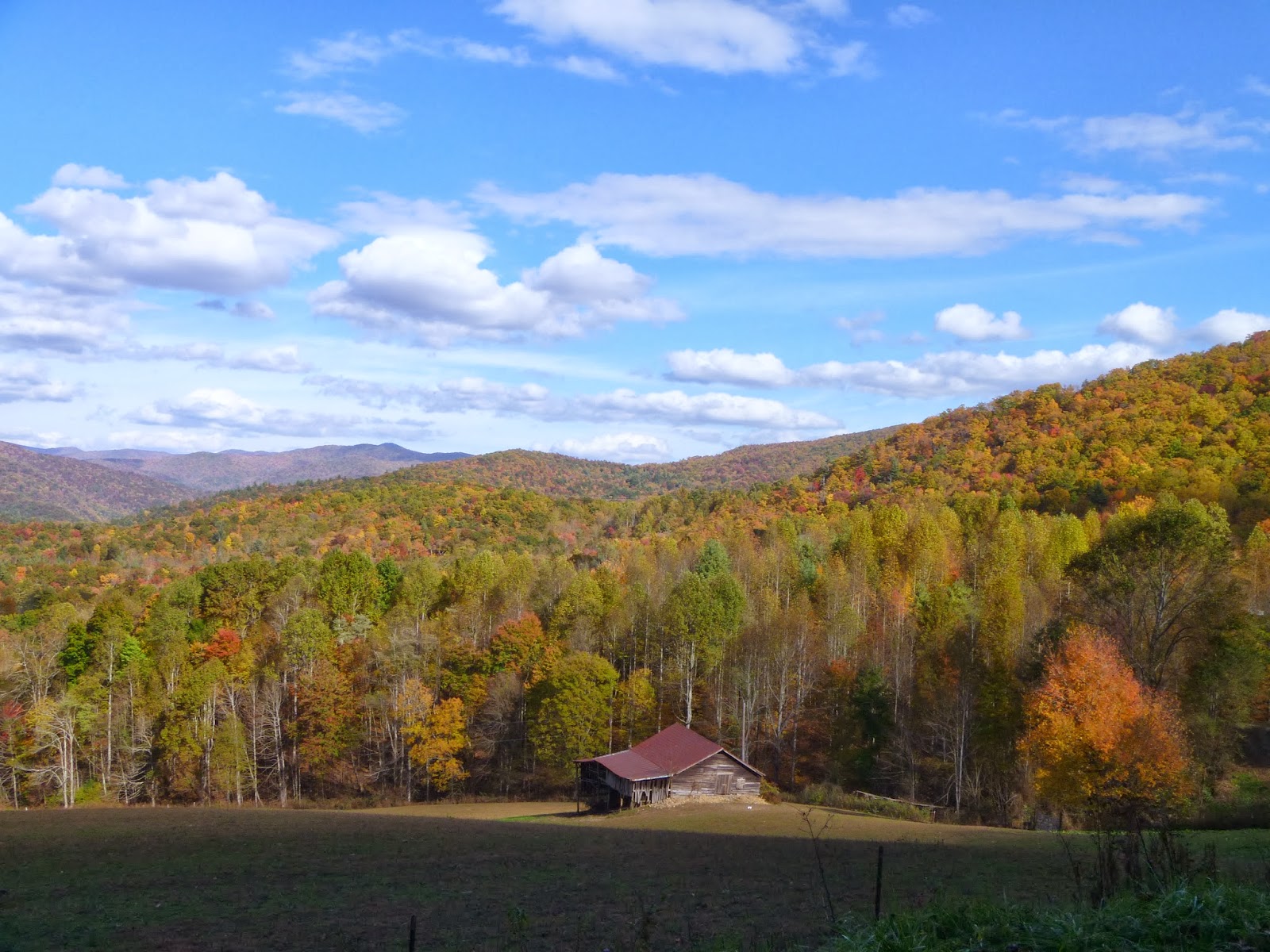
My fears are unfounded as I discover there is no traffic -- this is a road to nowhere eventually transitioning to a gravel forest road.  My wariness turns to rapture as I wind through the hardwood forest glowing autumn colors.

A turkey!

Crosby Creek


Boundary Road

This is one of the best routes of my Frizbo Fifty. Not only do I get to ride in the Smokey Mountains, but I'm checking off both Tennessee and North Carolina on the same day.  At the state line, I cross the famous Appalachian Trail (the "AT") which runs from Georgia to Maine.  I'll save that for another day.


Appalachian Trail X-ing

The "AT"
From the AT crossing, the boundary road descends sharply to Waterville Road and then climbs to Mt. Sterling. 

The valley before the climb to Mt. Sterling

Cows!

Mt. Sterling Road is well-packed gravel

Nice!
No, it's real.  I did not "shop" this photo!

Picture post card

The short-cut to Mt. Sterling

There are two trails to Mt. Sterling, you can drive up most of the way on Mt. Sterling Road and hike just the ridge 2.3 miles.  Or you can start at the Big Creek and hike 6 miles to the top -- which is tomorrow's itinerary.  But now I'm at the halfway point and it's time for lunch.

Mountain-cold


On the way down Mt. Sterling Road, I stop to chat with some motorcyclists on their way up.  They seem suitably impressed I got there on a bicycle.


An elk!

A bug!


On boundary road again, I'm hitting the wall.  Just then the motorcyclists come by and give me a big wave.  I put on a show by pedaling hard as they power by.


Finally I get to the campground road.  "Just 2.5 miles to go," I think.  But it's 700 feet straight up.  Gassed, I have to pull over about halfway up.  That's OK, because I have Dinty Moore Beef Stew and cold beer waiting for me at the camp site.


Poor man's TV

My own private campground

Cosby Campground

Day 2, Hike to Mt. Sterling
On my second morning in the Smokies, I drive over to the Baxter Creek Trail Head (aka Big Creek) and start the climb on foot to Mt. Sterling. 


Mt. Sterling Trail

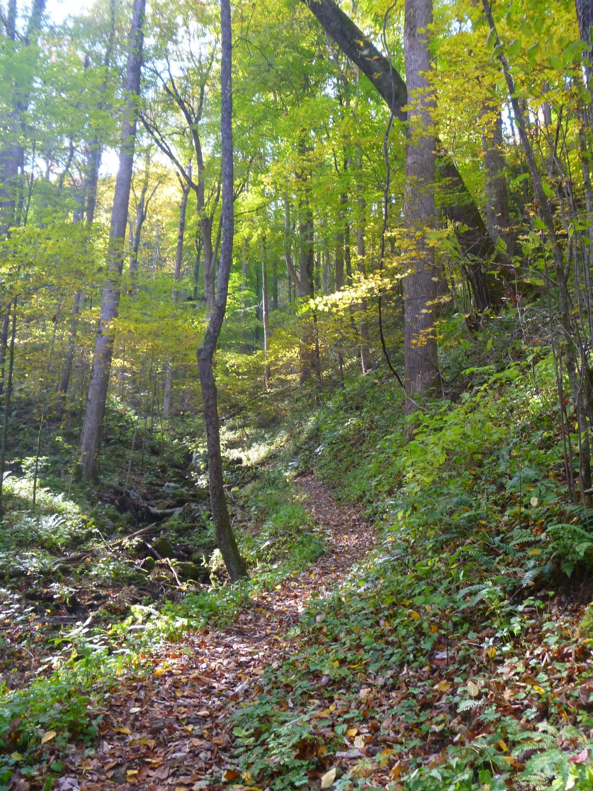
Forest floor or your new desktop wallpaper?

Hiking in the tunnel

One of the few remaining fire towers in GSMNP
Like most of the Appalachians, you rarely can see anything from the tree-covered mountain tops.  AT through-hikers refer to this phenomenon as "hiking in the green tunnel."  Fortunately, at the summit of Mt. Sterling is one of the few remaining fire towers in the park.  Open to the public, I climb up stairs to view dramatic panorama.


View from the fire tower

Just below the platform

If they don't take it down, it'll fall on its own
A fellow hiker informs me that the park service is tearing down the tower the next summer -- one of the last in the park.  Too bad.
View from the fire tower

Another cool bug!
GSMNP route

State:Tennessee & North Carolina
Date:2013-10-29
Route:Park boundary road from Cosby Campground to Mt. Sterling Ridge Trail
Distance:40 miles, +/- 5,500 ft.

Monday, October 28, 2013

Kentucky, Daniel Boone National Forest

Great Smoky Mountains Road Trip -- Day 2:  Driving south through Kentucky, I am planning to ride a section of the 200 mile Sheltowee Trace National Recreation Trail, but when I check the weather forecast, everything south of me is going to get wet today.  East of me is the Daniel Boone National Forest and the Red River Gorge which has a slightly better forecast.  So I re-route off of I-75 and head east into the national forest.

Soon I am on winding along gravel roads looking for a place to start my ride.  The national forest is networked with narrow roads connecting small farms and small towns.  True Appalachia the area has some of the poorest counties in the country.  I am a little concerned as where to park.  I don't want to encourage any anti-yankee vandalism ("Damn Yankee" is one word around here).  Nor provide an opportunity for petty theft.

"Bark! Bark! Bark!" A dog chases the car.  A few minutes later, "Bark, Bark, Bark!" from a pair of dogs this time.  No less than five dogs come out to hassle me.  "I'm not getting out of this car," I think to myself.  As much as I prefer riding unimproved roads to avoid traffic, the folks living along quiet country roads let their dogs run free -- and  that's a problem for bikers.  

When I get to a paved state road I decide to start my ride there, I will take my chances with the cars rather than the dogs.  And as luck with have it, I notice a patch of gravel at an intersection where someone has dumped construction debris.  This is the perfect parking spot -- if the locals are using this spot as a dump they won't mind if I park here and the intersection has enough traffic to discourage opportunists.
Parking reserved for construction debris and Yankees

Small farm building in rural Kentucky

Although a cloudy day, the beauty of the Red River Gorge area is apparent as I ride past small farm buildings and wooded hills.  On the map it looks like I can connect up a loop that will take me to some of the gorge's natural arches.

Quiet country roads

Choose your weapon!

In case of dog attack, I have three weapons.  Upon skirmish, I have imagined giving the dog a good squirt in the face with my water bottle might surprise and deter them.  I also imagine this might be hard with a vicious canine chewing on my foot.  So next, I might stab them the business end of my trekking pole.  And if all else fails, I'll blast the bastard with pepper spray.


Say "cheese"

Soon I am on the forest back roads which wander along the contours of gorge.  I can only maintain a general sense of my location and I hope I can find my way back.

Gravel roads wandering through the forest


With over 100 sandstone arches, the Red River Gorge has been described as "Arches National Park with trees."

Apple with a view


Burn from overheated disk brakes


At one point the road descends steeply and I desperately ride the brakes the whole way down.  At the bottom, I reach to tighten my disc brakes and feel something sting my finger.  To my surprise, it's not a sting.  I burned my finger on the overheated brake disc!

Six no trespassing signs -- OK, I think I get the picture!


From the map I can see I must cross a river to reach the Red River Gorge's famous arches and after exploring and hitting various dead-ends I am getting discouraged.  Finally, I am blocked by a simple clothesline armored by no less than six no trespassing signs.  Time to turn around.


On the way back to the paved road the dogs are waiting.  I hear the first start barking from a long way off.  As I ride I can hear him getting closer and closer.  I speed up to put a little distance between us and just get ahead of the dog as he emerges from the trees.  He chases me down the road for a bit and stops just long enough for me to get a picture before trotting off.

This dog chased me from a quarter-mile away!


Before I return to the car, I see another promising route, Forest Road 212.  Again turning off the paved road, I ride down a jeep trail which soon begins to follow and then merge with a creek.  As strange as it seems, this makes for some fun riding as I snake my way through the various water hazards. 

Forest Road 212 begins with well-packed gravel

And then FR 212 adds a little water

This is still marked as a road of the map, but looks more like a creek to me.

The perfect spot for lunch!


After a really fun bit of riding on the forest road/creek, I'm back to the paved road and I come face to face with another loose dog.  This time I'm already riding towards him when I first see him.  I unintentionally win the bluff when the dog turns around and takes off in a hurry.  I chase him down the road until he gets back home.  When he turns to see where I am, I have already ridden by.

I chased this dog for a quarter mile

Overall the day was a huge success, I missed the rain and the dogs. Next stop, Great Smoky Mountains!

Route: You can't get there from here

State:Kentucky
Date:2013-10-28
Route:Daniel Boone National Forest
Distance:21 miles

Sunday, October 27, 2013

Indiana, Brown Country State Park

Great Smoky Mountains Road Trip -- Day 1:  It's the first day of what I hope will be an epic road trip.  Just south of Indianapolis, Brown County features a variety of biking options in the state park, area roads and the Hoosier National Forest.

Idyllic fall day at Indiana's Brown County State Park

Today I'm biking the trails at the Brown County State Park.  The park is famous for its mountain bike trails and justifiable so.  The trails are extensive and well-maintained.  Some mountain bike trails, especially in the flatter mid-west, feel contrived, adding unnecessary twists and turns just to add mileage.  Brown County's trails flow in a way that makes sense -- they go where they should go.

Sweet single track!

The park itself is quite beautiful with ample facilities and many vistas.


Next stop, Kentucky! 

Ride Summary:

  • State: Indiana 
  • Date: 2013-10-27 
  • Route: Brown County State Park, Mountain bike trails and park's paved roads 
  • Distance:15 miles