Friday, September 25, 2020

Missouri, Berryman/Ozark Trail

New Mexico Tour, Day 1

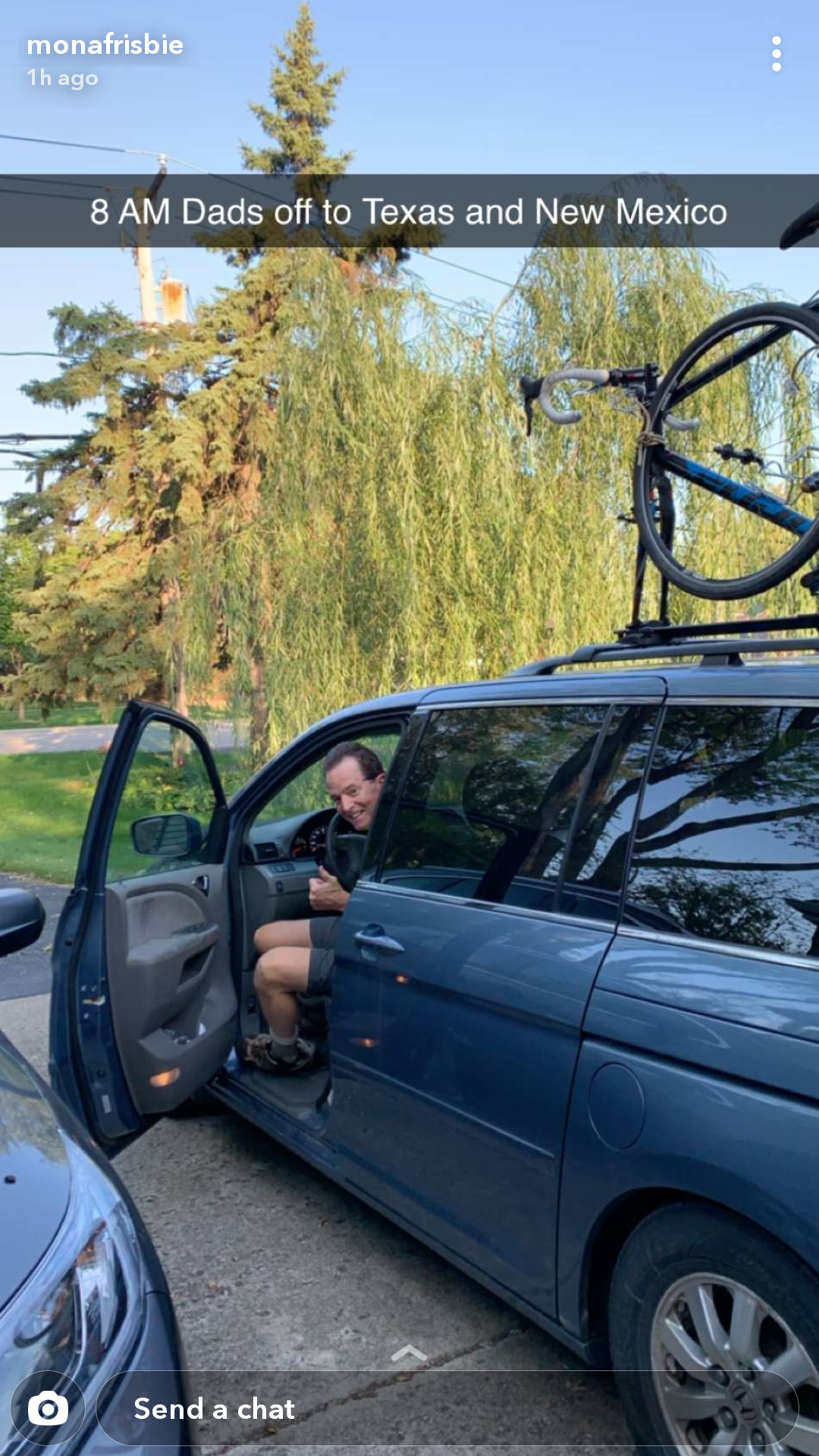
Earlier in the year, a 60th-birthday trip to Albuquerque, NM with my family was cancelled due to COVID.  With the start of fall, I was desperate for an adventure and New Mexico was still on my mind.  With a 8-day itinerary to New Mexico, I left Mount Prospect at 8:05 am.  

Two bikes and a mini-van!

I arrived in Missouri at 3pm at the Berryman Campground in the Mark Twain National Forest.  The small campground has only 8 sites, vault toilets and no water.  The camp sites are first-come-first-serve and free.  As I arrived early on a Friday, I had my choice of sites.  A few hours later, all the sites were full.  

With only a few hours until sunset, I didn't have time to ride the 27-mile Berryman Loop.  Instead I headed south on the Ozark Trail as an out-and-back to be sure that I'd be back before dark.

Berryman Loop/Ozark Trail

Berryman Loop/Ozark Trail

The Ozark Trail is a 230-mile backpacking trail running through the Missouri's Ozark mountains and most of it is open for mountain biking.

The trail started right from the campground.  I felt a little stiff after the long drive, but it didn't take long to loosen up on this really nice single track.  It also didn't take long to collect more than a few spider webs.  How a spider manages to rig a web across a trail is really a miracle.  Do they swing from branch to branch or wait for a breeze to blow them across the gap?  And they do it quickly too.  On my return leg, I gathered almost as many webs as the outward leg.  I only had time for a taste of this trail.  I'll have to come back and ride the entire Berryman Loop.  

Back at the campsite, I set up camp, collected firewood and cooked dinner.  As the autumn evenings can be long, I brought my guitar to entertain myself (and hopefully not annoy anyone else).  Just as I started to strum, something bumped my foot.  Looking down, I discovered a Copperhead out looking for dinner in the early dusk.  He seemed unbothered by my guitar playing and stopped long enough to pose for some pictures.    

Aww, a Copperhead welcomes me to Missouri

The Copperhead bite is painful but rarely fatal.

I followed the snake around my campsite until he slithered off into the bushes.  I resumed my guitar playing until again I felt something on my boot.  This time it was a walkingstick.  WTF, is it my guitar playing or maybe I should light the fire?


Northern Walkingstick

Once I lit the fire, I didn't have any more visitors in my campsite.  I did hear a fair amount of commotion coming from the picnic area -- loud voices, car engines.  When I left the next morning, I noticed many more folks had set up camp in the picnic area.  Usually camping in a day-use areas is discouraged, but on this morning no one seemed to care.

Ozark Trail route

Next stop, Arkansas!

State: Missouri
Date: 2020-09-25
Route: Berryman Campground to Ozark Trail (south to MM 39)
Distance: 10 miles

Friday, September 11, 2020

Hoosier National Forest, Indiana

Brown County, Nebo Ridge and Hickory Ridge Trails

Powered by my new full-suspension mountain bike, I was anxious to test it on some real trails.  Brown County and Hoosier National Forest are only a half-day drive and feature some very nice trails.

I started with the Brown County State Park Trails the highlight being Hesitation Point -- a nice piece of single track.  


Brown County State Park has a lot of single track


Photo using a poor man's drone (a lookout tower)

Next two days I rode in the Hoosier National Forest.  


Dispersed camping in Hoosier N.F.

I was awakened by gun shots. Unsure if the hunters knew I was nearby, I set off my car alarm. I'm guessing they didn't appreciate that. 


Cover art for my next album

I never did figure out what they were hunting as I checked to make sure it wasn't deer hunting season beforehand.

This trail is a climb!


Dork alert!  This biker is decorated entirely in safety yellow
(except for the orange Gatorade).

My safety yellow outfit terrified a horse. I had to hide off trail before the rider could convince his horse to continue.

Scouted this really nice dispersed campsite south east of Nebo Ridge 


Bike route: Nebo Ridge Trail


Bike route: Hickory Ridge Trail


  • State: Indiana
  • Date: 2020-09-10, 2020-09-11
  • Route: Nebo Ridge south and then north on Combs Creek Road; Trails around Hickory Ridge Horse Camp
  • Distance: 24 miles

Friday, July 3, 2020

Illinois, The LaSalle Purchase, Get Lost

Getting lost is not easy in today's GPS-tracked navigation-enabled world.  It wasn't always this way.   Years ago getting lost was a normal occurrence and to find one's way often required asking directions from the locals.

"Keep going, you can't miss it." 

"You can't get there from here."

"If you leave the paved road, you've gone too far."

When I worked in a gas station, providing directions to lost travelers was an expected service.  We even had a street-level map on the wall to give detailed answers.  The most common question was "Where's the post office?" 

"See that building directly across the street," I'd answer with a bit of a grin.  The driver would then sheepishly thank me realizing they'd given up searching a moment too soon.

Tree along the nearby Illinois River

While today's effortless navigation is a great convenience, we've "lost" something by always knowing where we are.  Our forbearers navigated over oceans, down rivers and across prairies guided only by the sun, stars and a bit of luck.  When they got lost, they weren't really lost.  They were simply exploring!

I have always been in awe of the great explorers: Captain Cook, Ernest Shackleton, Clark Griswold and wanted to follow their example.  But how?  The world has been thoroughly mapped, indexed and cataloged. 

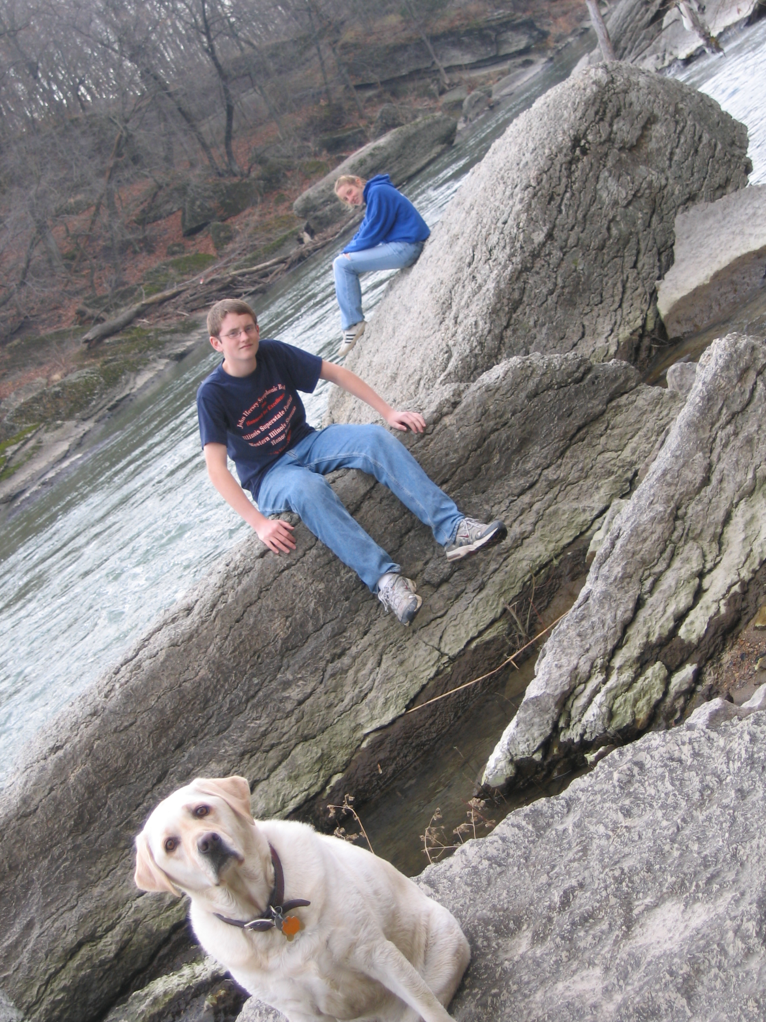
Searching for Bailey's Falls, 2005
 
In the days before smart phones, I heard about a waterfall on a tributary of the Vermilion River near Matthiessen State Park.  My inner explorer was intrigued.  Waterfalls are pretty rare in Illinois.  Discovering a waterfall would be epic.  Starting online, I found mentions of a Bailey's Falls located on land owned by a local quarry/cement company.  From the satellite view, the property was densely forested, crisscrossed by trails and appeared mostly abandoned.

"I've got to find this place," I thought.

The moonscape of quarry tailings, 2006

Using the excuse "it's a family adventure," I made several attempts with my wife and kids to find Bailey's Falls.  We tried by land, hiking cross-country from Matthiessen State Park.  We tried by sea, renting rafts from Vermilion River Rafting and hiking up Bailey's Creek from its confluence with the Vermilion.  Each time we were turned back by dense forest and dead-end trails.

Bailey's Falls at last!

On the fourth or fifth attempt, we solved the maze and found ourselves at the edge of, by Illinois standards, a spectacular waterfall.  When the water levels are high, Bailey's Falls is worth the effort with a pretty horseshoe shape and a 25-foot drop.


Route to Bailey's Falls, circa 2007

Look what I found

Having conquered the challenge, I didn't return for many years.  Fast forward to the summer of 2020.  We were in the depths of the COVID pandemic and I was crawling out of my skin looking for something to do.  

I learned the State of Illinois had purchased 2,629 acres of land from the cement company, Lone Star Industries.  The newly acquired parcel included a scenic stretch of the Vermilion River, Bailey's Creek and the waterfall.  Furthermore, the parcel linked Starved Rock State Park, Matthiessen State Park and the Margery Carlson Nature Preserve creating a combined area of 7,432 acres! 

The LaSalle Purchase, a hyper-park?

It then occurred to me that exploring the new parcel might be fun.  I had discovered the route to Bailey's Falls from Matthiessen State Park, but I had never explored the rest of the area.  By this time, phone navigation apps were available, so I set out to map the entire 2,600 acre parcel.

Over the pandemic summer of 2020, I made many trips to the parcel with my new mountain bike to map every feature and trail.  The IDNR had posted No Trespassing signs, so I was careful to go on weekdays when no one was likely to be there or likely to care.  I figured, "Hey. it's public land.  The public should be enjoying it."

Southern Gate 

Frisbie Ridge

North of the Vermilion River I found a landscape of rock tailings.  Long ridges of loose rock riddled with gullies cut by rainfall.  I recalled the moonscape appearance from my visits some 14 years earlier, but now tall weedy plants had managed to take hold.  The quarry itself was filled with water -- deep, blue and clear.  It looked inviting, but the shoreline looked treacherous with thick soft wet clay.  "Someday this will be a very pretty lake," I thought.

Bully Lake

Lone Star Trail

A jeep road circled the quarry and led to a bridge that linked the parcel to the cement company's main facilities north of the quarry.  I pedaled quickly past the buildings hoping to go unnoticed.  Continuing my exhaustive search, I found myself riding a narrow path under a thick canopy of dense trees.  At the end of which, I found a lodge-like building and some deer stands.  A dilapidated sign read "LONE STAR EMPLOYEE ARCHERY RANGE."  Later that same day I found a fishing pier and boat ramp on a small lake.  Apparently Lone Star opened parts of the land for employee recreation.


Archery Range


Mona Lake

The jeep road also led to an abandoned bridge across the Vermilion River connecting to the southern half of the parcel.  I was familiar with this bridge from my earlier expeditions to Bailey's Falls.  Crossing the bridge, the trails divided into a maze.  I now realized these were the remnants of an ATV trail system probably also used by Lone Star employees.

Bridge over the Vermilion River

Rafting on the Vermilion River

Again, I explored every path to it's end.  Sometimes this made for some exciting mountain biking.  Other times it was simply walking through deep mud and dense undergrowth.  


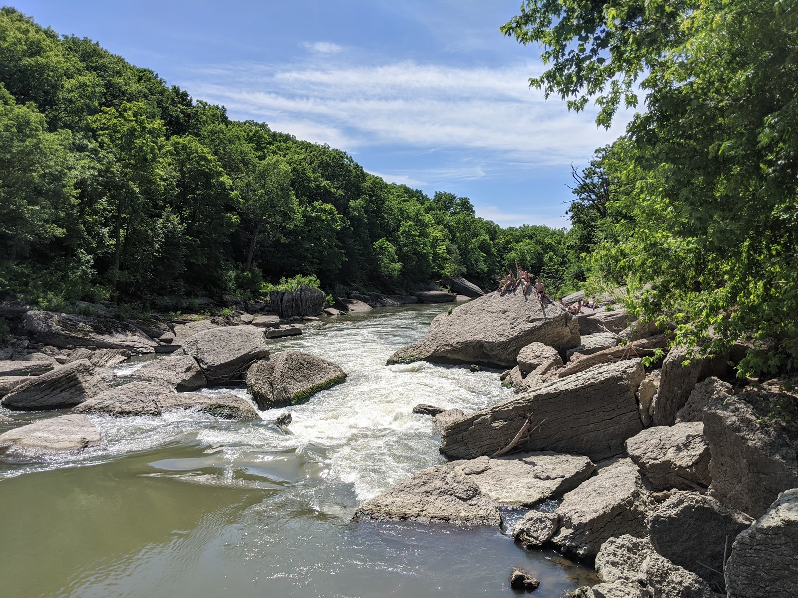
Wildcat Rapids

Local kids enjoying Wildcat Rapids

At some point, I returned to Bailey's Falls to find a group of high school kids jumping off the falls into the pool below.  They eyed me with suspicion until I engaged them in small talk.

"Where did you come from?" they eventually asked.  

"From the state park's river area entrance.  How did you get here?" I responded.  

"That trail right there," they replied pointing to a path.

And what do you know, there above the falls and across the creek was a break in the bushes.  

Backdoor Trail

"Ahh, the best explores aren't afraid to ask the natives for directions," I thought to myself.  I thanked the kids and walked my bike across the creek and up the other side.  Once on level ground, I jumped back on and rode the social trail until it dumped me off onto a lonely county road south of the parcel.  There I saw a couple parked cars and scattered beer cans.  I guess this is where kids from Ogelsby, IL go to have a good time.

Following the footsteps of the great explorers before me, I documented and named the geographic features I discovered.  Admittedly, the place names echo my family tree:
  • Mona Lake
  • Jordan Pond
  • Frisbie Ridge Trail
  • Bully Lake
  • #bridgie Trail
  • Matt's Swimming Hole
  • Jeff's Crossing, Not (a washed out culvert)
  • Matt's Backdoor Trail
  • Laffing Bluff

Northern Map

Southern Map


Laffing Bluff


Lone Star Trail

Old car in Bailey's Creek

Jordan Pond


Chillin' in Matt's Swimming Hole

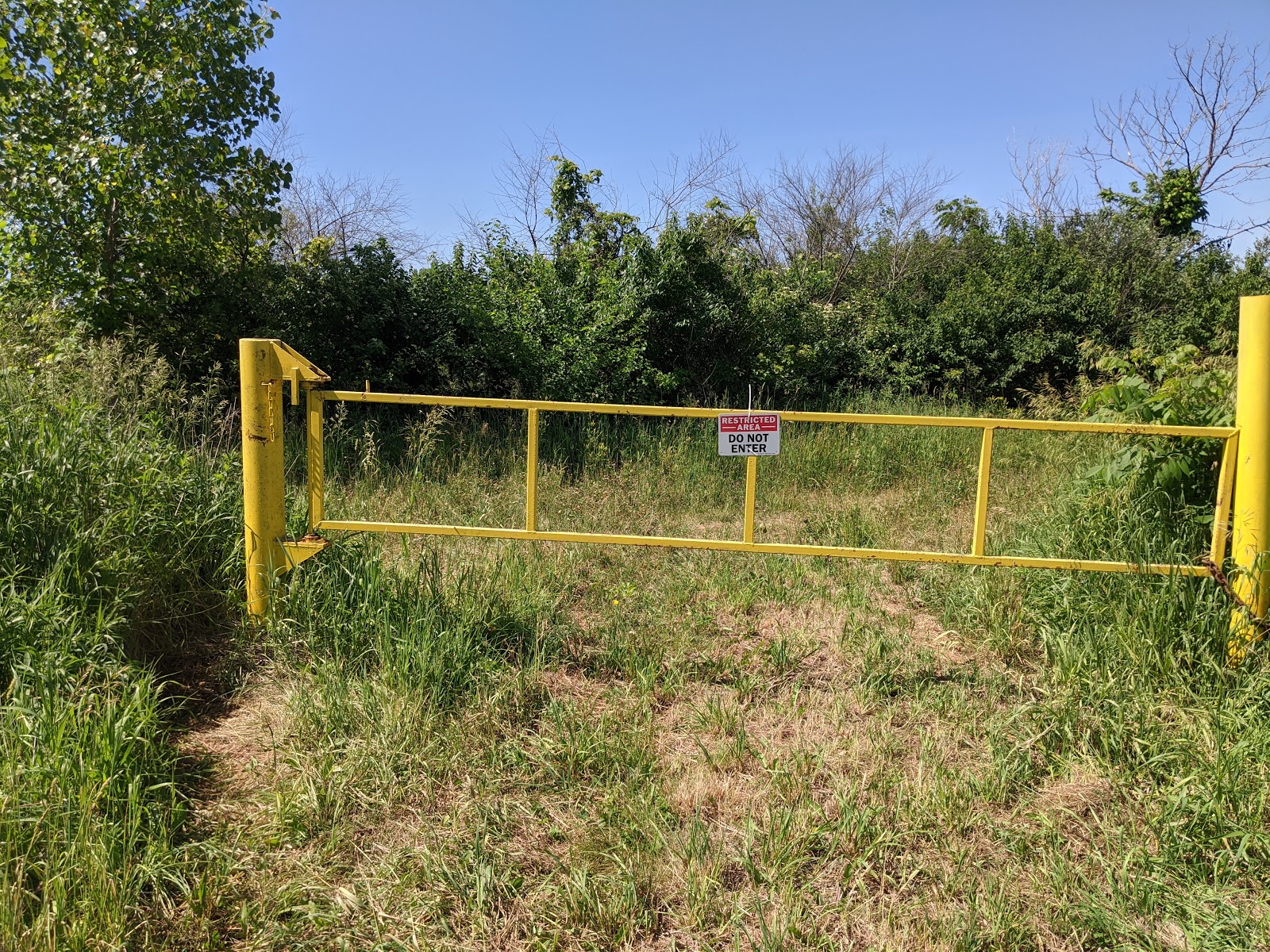
It was a grand adventure.  The whole time I explored, aside from the local kids and one biology field tech, I never saw another soul.  On my last expedition, I arrived early on the Friday before July 4th.  By now I knew my way around and used the day to ride the better trails for fun and take more photographs.  Cruising back to the car without a care, I zipped through the path in a dense hedge that bypassed the state park gate and nearly ran into the rear bumper of a Illinois Conservation Police pickup truck.

Yellow Gate

Busted!

He was there to prevent visitors from wandering onto the new parcel during the holiday weekend and I didn't realize Friday was the extra day off.  Everyone kinda hates mountain bikers, so when I came blasting out of the bushes in full biking regalia right by the No Trespassing sign I didn't make a sympathetic character.  Fifteen minutes later I was the proud recipient of a $195 trespassing ticket.

Some months later, I got involved with a Sierra Club group seeking to address the COVID overcrowding at the state parks, especially Starved Rock State Park.  The answer was obvious.  Open the new parcel to visitors.  The idea had merit.  The new parcel was easily accessible from the Matthiessen State Park's parking and picnic areas.  With a little clean-up, a viable trail system already existed.  I presented my ideas to the club and forwarded it to the IDNR. 
 

Presentation sent to IDNR


My brother even wrote an editorial in the Chicago Sun-Times supporting the idea.  I never got a response.

Chicago Sun-Times Editorial

As of 2024, nothing has changed except the parcel has been opened up to seasonal deer hunting.  For a budding explorer, it's still uncharted territory.  Enjoy, explore, protect -- at your own risk.

State: Illinois
Date: Summer of 2020
Route: Various trails and paths in the LaSalle Purchase
Distance: 15 miles

Tuesday, March 31, 2020

Pandemic Birthday

With the pandemic, everyone’s celebrations are necessarily subdued. For my 60th birthday, I had dinner with my 96 year-old mother – just the two of us.


Patrick: “60 years ago I was born. Tell me the story.”

Margery: “So it’s 9 o’clock in the morning on the 31st of March and I’m in the labor room. And I’m in the bed. And Richard and Dr. O’Connell are chatting away ignoring me and whatever my problems were and I finally said, ‘Dr. O’Connell, in two more pains I’m going to have a baby.’ Now we’re nowhere near the delivery room, we’re in the labor room. Dr. O’Connell, who was a lovely man, said, 'Well, if you do, I’ll buy you a Coke.’ and left.”

Patrick: “And left?”

Margery: “And left!”

Margery: “And so then I had two pains and your head starts to come into the world. So Richard -- I would have stayed to see my child born -- but Richard went to find Dr. O’Connell. So Dr. O’Connell’s gone. Richard’s gone.”

Patrick: “Are you in the room alone?”

Margery: “No, there was a nurse there and she delivered the baby.”

Patrick: “O’Connell didn’t get back in time?”

Margery: “No, I never saw him until later in the day.”

Patrick: “So Dad missed the whole thing?”

Margery: “He missed the whole thing, but deliberately. That was not Richard’s sort of thing.”

Patrick: “Back then, the men were expected to wait in the waiting room. It wasn’t a shared thing where they cut the umbilical cord and all that?”

Margery: “Yes, but that was fine with me. It was the easiest birth I had.”

Patrick: “Did you get the Coke?”

Margery: “Yes, he came in the afternoon with the Coke. And I got billed for the delivery room -- automatically of course. I thought, I’m not paying for the delivery room, I never saw the delivery room. I complained and they took off $25.”

So there you have it, my birthday story, a moment we shared 60 years ago -- just the two of us.

Tuesday, October 22, 2019

Maine, Acadia National Park, Must Get Rocks!

New England Trip, Day 7, 8, 9, 10

Our final stop of the trip was the crown jewel of the north Atlantic coast, Acadia National Park.  We booked the most interesting accommodations of trip too -- an ocean-side B&B and organic farm of sorts.  The website spoke of a retired couple growing their own food, making cheese from their goats' milk and raising free-range chickens -- this could be pretty cool.  After a long drive from New Hampshire, the wife greeted us and led us to the upstairs room.  It was small with a beautiful view and neatly decorated with lace covered end tables and flowered pillow shams -- just like the picture.  By the time we unpacked, showered and crawled in to bed, the place was completely trashed.  Funny how that happens.

At breakfast we expected an organic feast, but the meal, while nice, was standard fare.  Again, the wife served our breakfast and engaged in some casual conversation.  I found the conversation somewhat off-putting as she interrupted me several times in a rather dismissive way.  She also complained about her farm chores, feeding the chickens and the long walk to the goat barn.  This was not at all what I expected.  I felt like saying, "Hey, you can talk to your husband like that, but your should be more polite to your guests."


After half-hour drive, we arrived at the Hulls Cove Visitor's Center.  After a look-see at the visitor's center, we unloaded the bikes and rode out on the park's carriage roads.

The construction of Acadia's carriage roads were financed and directed by John D. Rockefeller, Jr., an experienced horseman who wanted to travel by horse and carriage without annoying motor cars. Between 1913 and 1940, he built 45 miles of carriage roads within the park leaving a wonderful legacy to the bike riders of today.  The crushed native stone and well-graded trails make for very nice biking.

We rode to Jordan Pond with a stop at Conner's Nubble for lunch.  The weather was cloudy, but mild -- another bike ride win!

Acadia!

Acadia Nation Park's carriage roads

For lunch, we parked the bikes and hiked out to Conners Nubble.  Nearby are two peaks: South Bubble and North Bubble -- gotta love the Acadia's place names.

Conners Nubble overlooking Eagle Lake


Alternating bites of apple and granola bar make a delicious snack


I had been waiting until Maine to have lobster, so when we saw this quirky restaurant on the way back from Acadia, we knew we had to eat here.  They did not disappoint, it was definitely quirky and they definitely served lobster.

Perfect spot for dinner

Seafood platter

For our second breakfast at the B&B, we were joined by another couple which made for a better conversion.  The husband was particularly quick-witted and funny.  The B&B owner joined in and shared that her husband had died several years ago.  The B&B/organic farm was his idea and she still hadn't gotten around to updating the website.  A retirement dream that ended too soon.  It seemed really sad.  Boy, was I glad I hadn't made the snarky husband comment the day before.

After days of beautiful fall conditions, our luck with the weather finally ran out.  It was raining and the forecast was nasty until late afternoon.  Time to break out the rain gear.  A trail ran from the B&B to a local park.  We checked out the B&B's goat shed, and then hiked to Tidal Falls Nature Preserve which overlooks a narrows in Frenchman Bay and features whitewater that reverses with the tides.  

Our one day of bad weather

The park also features a small visitor's center and some sculptures.

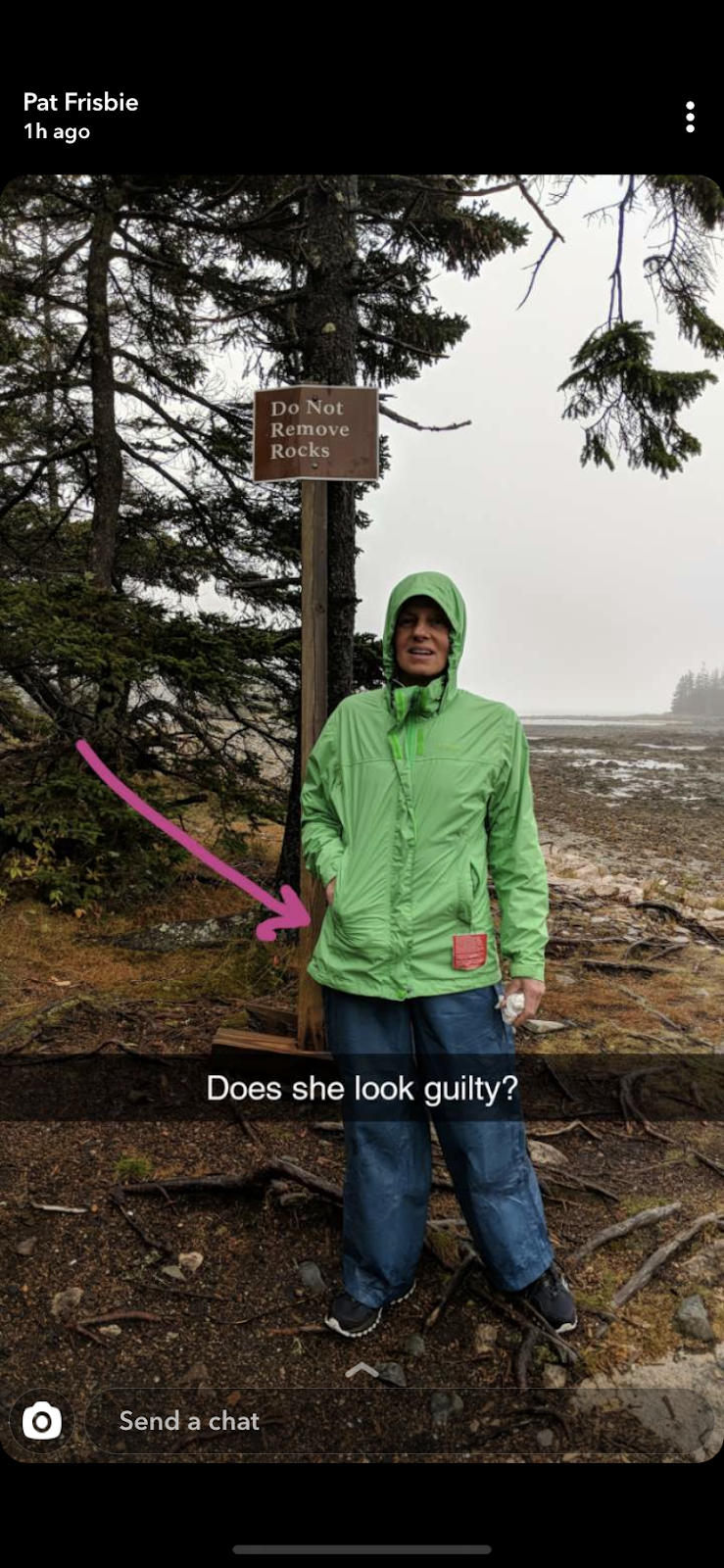
"Honey, if I collect the rocks, maybe you could build me one of these?" Mona suggested as she contemplated one of the park's sculptures.

"Could you build this for me?"

Collect rocks?  What can I say about Mona's collecting?  What first springs to mind is Lucille Ball who's character in the movie "The Long, Long Trailer" hid her immense rock collection in the trailer while Desi navigated a cliffhanging route through the mountains.  Like Lucy, Mona can't resist a souvenir rock.  During our hike along the Rhode Island's Cliff Walk, I scrambled down a steep embankment to the water.  I called to Mona to follow and she declined until I mentioned, "There are some rocks down here."  Next thing I know, she's down the embankment and scouring the shore for interesting rocks.

Must get rocks!

But a better comparison is the activities of one 18th-century European polymath, Alexander von Humboldt.  Humboldt travelled extensively through Central and South America documenting his explorations with a scientific view and collecting everything he could.  At one point, Humboldt almost drowned crossing a Venezuelan river because he overloaded his canoe with rocks, seeds, plants and even live animals.

Like Humboldt, Mona collects everything: rocks, shells, leaves, drift wood.  Once she smuggled giant seeds from Costa Rica.  The seeds were the size of ping pong balls.  Mona displayed them in a decorative bowl.  Several months later, she heard a loud popping sound and discovered the seeds had burse open -- releasing who knows what into our house.

After that, I was a little more circumspect about bringing home biological agents from foreign lands.  On a bicycle ride to Grazalema, Spain, we found ourselves in a forest of cork trees.  The bark of the cork tree is harvested every nine years leaving the trunk of the tree looking much like a freshly shaved poodle.  The bark is thick and spongy and, of course, Mona collected some samples.

"You know, the Emerald Ash Borer was introduced to the US via the bark of shipping pallets." I cautioned Mona.  "We could get in real trouble bringing that cork bark home."

"Oh, you're such a goodie-two-shoes.  Take some chances in life!" she replied as she hid the cork in her luggage.  There was no reasoning with her.  I did quarantine the bark in a plastic container until I could seal it with polyurethane.  It looks very nice displayed next to the burst Costa Rican seeds in a large bowl on our dining room table.  

What does this woman have in her pockets?

The bowl holds an interesting collection: a dozen perfect Sand Dollars from San Vincent Island, an alligator's tooth from Wakulla Springs, a 1.7 billion year-old piece of Vishnu Schist granite from the North Kaibab Trail that tried to kill me, an Orioles' nest, the claw of a Great Horned Owl.  Each item has a story and if you bring some wine, we'll tell you all about it.

Not everything gets displayed.  Our kids followed Mona's example in collecting treasure. When each vacation resulted in an additional box of shells, rocks, drift wood and even baggies of beach sand, we needed to make some compromises.  The compromise was to dump the excess outside, along the foundation of our house.  No need to go to Florida, you can beach comb right outside our front door.

Sometimes I have taken stricter measures to curtail the collecting.  When the kids were little they would hand me "a treasure" to bring home every 100 yards.  My technique was to dump the stuff temporarily behind a trail marker or some other easily remembered landmark.  If the kids remembered and asked, I'd go back and get it.  If they didn't remember, which was usually the case, it stayed there to be found by the next lucky treasure seeker.  "Oh look, a stick!"  Even with my precautions, I still occasionally find my pack a little heavier at the end of the hike. "How did these rocks get in my side pockets?"  
L-u-u-c-y!

---


Schoodic Peninsula

After our hike near the B&B, we drove to Acadia's Schoodic Peninsula.  Not as dramatic as the main part of the park on Mount Desert Island, the drive around Schoonic Peninsula offers nice views of the water and access to some easy hiking.  By the time we circled the park, the rain had stopped and we enjoyed a very nice picnic dinner at Frazier Point.

Sunset at Frazier Point, Schoodic Peninsula

The next and last day at Acadia was cool, clear and breezy.  A good day for hiking.  My niece Emily had posted a recommendation to my Instagram account, "Do the Precipice trail.  It's my favorite trail ever!"  Based on the trail's name and the fact that the recommendation came from someone who convinced her father to build a trapeze in the back yard so she could train to become a circus performer, I carefully read the trail descriptions before committing to a route.

You've been warned

The trail descriptions included the phrases "exposed cliffs that require climbing on iron rungs" and "serious injury and death."  Hey, this could be fun.  In order to dial it back a notch, I suggested we hike/climb the Beehive Trail which seemed to be a slightly easier version of the Precipice Trail.


The moment Mona realized she might die

I was very explicit with Mona about the route and she was game until we got to the second set of rungs and she realized that "serious injury and death" was not an exaggeration.  

"It's too late to turn back," I told her.  "It's more dangerous to climb down than up.  We must go up.  From the top, there's an easier route back down."  With that, Mona stiffened her resolve and climbed on. 

But didn't

The scary part didn't last too long and quicker than you can say "acrophobia" we were having lunch looking out over the Atlantic Ocean.


On our return home, I drilled holes in Mona's Acadia rocks and mounted them on a steel stand in the garden.  Not quite the same as the sculpture in Maine, but I'm calling it a win.


Acadia-sourced rocks, an artisan stand, $24 in masonry drill bits and 2 hours of drilling.

'Nuff said.


Biking route at Acadia N. P.


Six states, ten days, twenty miles hiked, one hundred miles biked.  Great trip.

State:Maine
Date:2019-10-22
Route:Hulls Cove Visitor Center to Jordan Pond House
Distance:18 miles