Saturday, May 18, 2019

Delaware, Michael Castle Trail

Potomac and Delaware Rivers Trip -- Day 4

The previous night I drove most of the Susquehanna State Park's roads in the dark looking for the campground, so in the morning I retraced my route to see what I missed.

Flint Furnace on Deer Creek, Susquehanna State Park
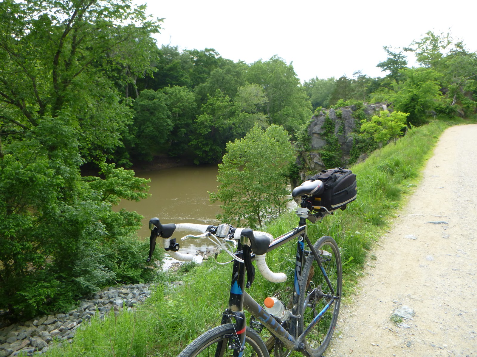
Another megalith!
Next up was Delaware, only an hour drive.  Today's route combined the Micheal N. Castle Trail and the Ben Cardin Trail running along the Delaware River between Chesapeake City and Delaware City.  Paved, flat and fast, it was a nice change from the limestone trails.
Chesapeake City


Paved, flat and fast


#bridgie

The canal was a shortcut between Baltimore and Philadelphia


One of those moments where I wished I had a biking buddy to share a cold one with 

Local fishermen on the Delaware River 

Boat parking

The vultures have taken over Fort DuPont


Avoid the state park's entrance fee, park here.


Phew!

My original plan was to take a break from camping to stay in a hotel in trendy New Hope, NJ.  When I checked for a last minute reservation, the rates were over $300.  It was Saturday night so I shouldn't have been surprised, but $300?  I checked around for another hotel and found a motel for $159 but it was out of the way.  Would I rather pay $300 for a nice bed and private shower or sleep in the van again.  Beaver Valley Campground here I come.
Beaver Valley Campground


Route along the Chesapeake and Delaware Canal


State:Delaware
Date:2019-05-18
Route:Chesapeake City to Delaware City and Fort DuPont State Park
Distance:33 miles

Friday, May 17, 2019

Washington, DC, Chesapeake & Ohio Canal, Capitol

Potomac and Delaware Rivers Trip -- Day 3

Another nice day, today's destination -- Washington D.C.  As D.C. is notorious for traffic, I parked at the Carderock Recreational Area and headed towards to the capital by bike.


Breakfast!

Another megalith at Antietam Creek!


Pay attention paddlers!
The biking surface here is much nicer than yesterday's ride.  Well-packed limestone the whole way.


Whitewater obstacle course

The old canal enters the city


The national mall is crisscrossed with paths, sidewalks and biking lanes which makes for some fun exploring.  The main obstacles were the other tourists and accidentally violating protocols.  I was informed that bike riding was inappropriate in Arlington National Cemetery and later chased away by armed guards at the rear of the capitol.  I missed my chance to break another protocol when I witnessed the presidential motorcade go by -- at least ten vehicles including an ambulance.  I briefly saw a silhouetted figure waving from inside a limousine.  Damn, I missed my one chance to flip Trump off in person. 


Another megalith!


Photo bombing everyone's pictures by lunching on the Capitol steps!

President Turd's Motorcade
Exiting the mall, every bit of visible roadway was crammed with cars inching along.  How do these people do it?


C&O Canal
On my return, I rode a few extra miles to Olmsted Island.  The island is perched in the middle of the Potomac with a perfect view of the Great Falls. 

How to avoid DC traffic

My feeling of superiority over the DC commuters was short lived as I left Carderock for Susquehanna State Park.  I battled my way out of Washington D.C. and luckily rush hour was over by the time I hit Baltimore.  I arrived at the state park in the dark and wandered around a bit on curving roads until I found the campground and my reserved campsite.  After dinner, I checked out the shower facilities -- clean, not crowded and hot water -- nice.


State:Washington, D.C. (Yea, I know it's not technically a state)
Date:2019-05-17
Route:Carderock Rec. Area to Capitol and Olmsted Island
Distance:39 miles

Thursday, May 16, 2019

Maryland, Chesapeake & Ohio Canal Trail, Antietam National Battlefield


Potomac and Delaware Rivers Trip -- Day 2

In the morning, I took a quick peak at the views from Coopers Rock which looks over the Cheat River.  No time for gawking, today was a big ride on the C&O Canal Trail.


Coopers Rock Overlook

Strange megalith at Coopers Rock


I rode from Fifteen Mile Creek to the notable 3000-foot-long Paw Paw tunnel.  This part of the trail is also notable for rocks and mud so I rode the hard tail bike.


C&O Canal Bike Trail at Fifteen File Creek


Canal Lock

Paw Paw Tunnel


This section of the C&O canal is a bit sketchy


Perfect spot for lunch, Purslane Run Campsite


Friendly Butterfly

Shed snake skin


Campsite at Fifteen Mile Creek along Potomac River 
A little muddy at the end of the day
Another one of these weird megaliths at 15 Mile Creek

On my way to my campsite at Antietam Creek on the Potomac River, was the namesake national battlefield.  As with most battlefields, the grounds made for some nice biking. 


The "Cornfield," Antietam National Battlefield
Second Corps Memorial, Antietam National Battlefield  

Infamous "Bloody Lane"


Antietam Creek Campsite, C&O Canal

I'll never be too old to enjoy a hot dog cooked over an open fire

State:Maryland
Date:2019-05-16
Route:Fifteen Mile Creek to Paw Paw Tunnel and mm 59/Toured Antietam National Battlefield
Distance:35 miles/6 miles

Wednesday, May 15, 2019

Ohio, Camp Chase Trail

Potomac and Delaware Rivers Trip -- Day 1

It's a springtime ritual, waiting for the warmer temperatures and dryer weather so I can hit the trails.  I had hoped to travel to Louisiana, but the Mississippi was in flood, so I looked eastward.  Happily, I scouted a route though Maryland, Delaware and New Jersey with some great biking and optimistic weather forecasts.  I got a green light from Mona, loaded up the van and was on my way.


First pit stop, Indiana

The first day is mostly driving, but I stopped in Ohio to stretch my wheels.  The Great American Rail-Trail is a work-in-progress initiative to develop a coast-to-coast bike trail and I'd thought ride some of the Ohio portion.   

Nice park east of Columbus, OH, just of I-70

Not too far off the interstate is Battelle Darby Creek Metro Park.  I parked near the visitor's center, rode the park's paths and then linked up to the Camp Chase Trail (part of the Ohio to Erie Trail and the Great American Rail-Trail).

Bison pasture, but no bison


Camp Chase Trail

London turn-around
After a fast 30-mile out-and-back, I was back in the truckster and headed east.  The itinerary required a long driving day -- 570 miles.  I was glad when I arrived at the Coopers Rock State Forest campground in West Virginia.


Campsite at Coopers Rock State Forest, WV
Ohio route

State:Ohio
Date:2019-05-15
Route:Battelle Darby Creek Metro Park to London, OH
Distance:30 miles

Thursday, March 21, 2019

California, 17 Mile Drive, Who goes to Pebble Beach to ride a bike?

Each March I am obligated to travel to California for the Sierra Club's Spring Meeting -- a gathering of the trip leaders to discuss outings, safety, gear and bitch about participants.  What might seem as an inconvenience is actually on opportunity to visit my son Matt who lives in the bay area.

This year my daughter Lauren volunteered to fly in from Seattle, join Mona and me on a short adventure, and hang with Mom while I attended the meeting.  We met at SFO and drove down to Monterey.  After a two hour drive, we arrived on the Pacific coast and bike rental called Adventures by the Sea.  As we walked over the to rental kiosk, Lauren and I checked out the bikes.  OMG, they were rusted out pieces of junk -- too many miles and too much sea air.  A quick Google search offered a bike shop across town, Work Horse Bicycles (highly recommended).  Wow, what a difference.  The Work Horse rental was only $1 more per day for far superior bicycles. The service was quick and professional. They sized our bikes with just a look, gave tips on the route and we were on our way. The bike trail is only a couple blocks away and the bathrooms were nice (always important to the girls). 

Pacific coast


View from China Rock

Who goes to Pebble Beach for a bike ride?
The dedicated bike trail runs through town and then connects with the famous 17 Mile Drive.  Famous for its ocean views and the Pebble Beach Gold Course.  We rode the entire shore to Carmel Way.  At Carmel Way, we faced a choice.  We could continue down to Carmel by the Sea, but it was a pretty big descent and we didn't relish the climb back.  Or we could continue on 17 Mile Drive as it cut back across the peninsula, but it seemed like a lot of traffic was using that route. Or we could retrace our ride along the coast.  Yep, let's ride the shore again.

17 Mile Drive

Nap time
That night we stayed at the Gosby House Inn (good deal in the off season).

Creek bottom on Fan Shell Beach

On Friday, we drove 20 miles north to the Elkhorn Slough State Marine Conservation Area and rented kayaks from Monterey Bay Kayaks (recommended).  The Elkhorn Slough is really an amazing place.  Within the first half hour we saw dozens of sea otters -- mostly floating as "rafts."  They hold hands while floating on their backs.  Sea otters spend all their time eating, sleeping, grooming or taking care of their offspring.

The shores were covered with harbor seals and sea birds were everywhere.  This is a naturalist's bonanza -- not to be missed.  We paddled upstream almost to the end, but the best wildlife viewing was closest to the bay. 


Elkhorn Slough


17 Mile Drive biking route

Gathering intelligence on Matt's taste in art


State:California
Date:2019-03-21
Route:Old Fisherman's Wharf (Work Horse Bicycles) to Carmel Way
Distance:30 miles