Saturday, May 28, 2011

Illinois, Jo Daviess Fox Hunt and Wine Tasting


While not an epic ride in terms of distance and difficulty, this ride in Jo Daviess county was a gem.  After driving to my sister's "farmette" for the Memorial Day weekend, we rode the local gravel roads to a wine tasting at the Massbach Ridge Winery.

Rolling countryside of Jo Daviess County.

Quiet country roads.

If I were a horse I would want to live here!

Teresa and Jenna (Jenna's the horse)

Wine tasting at Massbach Ridge Winery


Fox Hunt Hounds
"Pet me!"

Dinner at the farmette.
Bike route followed the path of the annual fox hunt.


Sadly, this was the last time we visited my sister's farmette before she sold it.

-- Frizbo

State: Illinois
Date: 2011-05-28
Trail: Jo Daviess County fox hunt route
Distance: 12 miles


Monday, May 9, 2011

Pennsylvania, Allegheny National Forest, Singing to Bears

After a day biking in Ohio, I arrive in Pennsylvania's Allegheny National Forest (Why a Frizbo Fifty?). My first stop is the Marienville Ranger Station.

"I'm interested in some mountain biking!" I respond when queried by the ranger. The forest district, while not known for mountain biking, does have extensive trails for All Terrain Vehicles (ATV). These trails are closed to ATVs before Memorial Day, so it seems like a good opportunity to do some mountain biking without the threat of being roadkill.

Based on the ranger's cold stare, I get the feeling this ranger doesn't like me or mountain bikers in general. Reluctantly he points out the nearby ATV trails and parking lots. I try to warm him up. I gesture to the stuffed bear on display. "So, are there a lot bears around here?"

"Oh, yea, lots of bears. Worried?"

"No, black bears don't scare me," I answer. I have encountered enough black bears to know that they will quickly run away with just a little encouragement. "Grizzly bears scare me, but not black bears." I offer, trying not to sound like an urban dweeb worried about bears, snakes and poison ivy.

"Well, let me tell you about black bears," he retorts. "If a grizzly bear attacks you, you can play dead. But if a black bear attacks you, you'd better fight back, cause he plans on eating you."

"Really! And exactly how many people have been killed by man-eating black bears in the Allegheny National Forest?" I am tempted to reply, but I instead I simply thank him and head to the trail head.


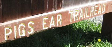
From the "Pigs Ear Trailhead" there are 28 miles of ATV trails.

To the west is the Marienville Trail, rated "more difficult" and to the east, the Timberline Trail rated "easiest." I start west to find out the meaning of "more difficult." After a mile of smooth packed gravel trail, I come to a steep climb paved in concrete blocks and covered with pea gravel. It's like riding on loose marbles -- a mountain biker's nightmare. I guess I have to stick to the easier trails (I later noticed this was a downhill only segment of the trail and there was an uphill bypass).

Marienville ATV Trail, "More Difficult"

Backtracking and heading east, I find myself riding primarily forest service roads. Soon I discover the forest is a maze of access roads for oil and gas wells. Poor signage combined with poor maps and I quickly have lost my way. But with all the service roads, I simply pick a road and head north and west until I pick up the trail again.

Oil/gas field access roads


Oil and gas wells every 200 yards!

National forests, unlike national parks, are a resource to be harvested, but this place is disgusting with the sound and smell of wells permeating the forest. I feel like I'm riding in an industrial park. By the time I return to the car, I am pretty disappointed. There has to be some better trails than this.

Kinzua Dam

I drive north to the Allegheny Reservoir and with the sun setting I take a quick hike out to the tops of the bluffs overlooking the reservoir. The northern part of the forest district is much prettier with far fewer roads and wells. On the way back to Warren, the nearest town, a small black bear bolts across the road right in front of my car.

"So, they do have bears here. I wonder if it's a man-eater!"

As I mentioned, I have had some run-ins with black bears. Once in the Porcupine Mountains, I greeted a bear on a pitch-black night by saying "Hey Ron, is that you?", but the most interesting encounter occurred in the Shenandoah National Park. It was a family vacation with my wife, two kids and the dog and we had just finished a canoe trip on the Shenandoah River. We were now headed to the next phase of the trip, a rustic cabin in the national park. Driving through this part of Virginia, we noticed just about everything is named Shenandoah: Shenandoah National Park, Shenandoah River, Shenandoah Drive, Shenandoah View Apartments, Shenandoah Cleaners. Feeling a little punchy after day five of the family vacation, my wife began singing John Denver's "Country Roads" every time one of us said the word "Shenandoah."

Almost heaven, West Virginia
Blue Ridge Mountains, Shenandoah River
Life is old there, older than the trees
Younger than the mountains, blowing like a breeze 

While it was funny the first six times, we were circumspect by the time we got to the trailhead in the S-word National Park (our working euphemism to prevent further outbursts of Country Roads).

The rustic cabins, managed by the Potomac Appalachian Trail Club, were built by the CCC when the park was developed. These primitive cabins are equipped with mattresses, blankets, and cookware. A pit toilet and spring water are nearby. The cabins can only be reached by hiking well into the park and offer an excellent base camp to explore the surrounding trails and forest.

By this time it is late in the day and we are hustling to get to the cabin before dusk. On the spur trail to the cabin, as we are arm-carrying sleeping bags, camping gear and food, we come upon a black bear munching on blue berries.

"Oh, My God! It's a bear!"

"Don't run. Stand together. Look big, he'll run away."

By this time the bear notices us, gives us a long look, and then goes back to eating blue berries.

"He's not leaving!"

"Make some noise. That will scare him."

We make some rather half-hearted yells and shouts which the bear totally ignores.

"He's still not leaving! What should we do?"

"Hmmm, I know, let's sing the song."

"Almost heaven, West Virginia..."

I don't know if it was our singing or maybe bears just don't care for John Denver, but before we finished the first verse, that bear had skedaddled into the woods. Like I said, they just need some encouragement.


Allegheny Mountains

That evening back at the hotel in Warren, PA, I search the web looking for non-ATV bike trails. I find a recommendation from the local bike club website, text my wife that I survived today's adventures and hit the hay.

At last, some single track!

Today, I ride the Tanbark Trail -- a hiking trail that runs from the plateau down to the Allegheny River. This is still early spring in the Allegheny Forest. Only two weeks ago they had eight inches of snow here. Despite a trail covered in autumn's leaves and winter's branches, the ride is exhilarating as I glide through the trees benefiting from a gentile downhill slope.

Spring arrives late in the Allegheny Mountains

Soon the Tanbark Trail becomes steep and rocky. I dismount and walk the remaining mile or so to the river.

"The only extreme thing about my mountain biking is I am extremely careful" -- Frizbo

At the river, I know there is no way I can ride back up the Tanbark Trail. Instead I follow the river road looking for a gravel road going up and east. After some wandering around and a hellacious climb, I discover a fantastic forest road, FS-119, that winds along the Hickory Creek Wilderness Area and right back to the car. Here the Allegheny Forest is preserved for outdoor recreation and is undeniably beautiful.

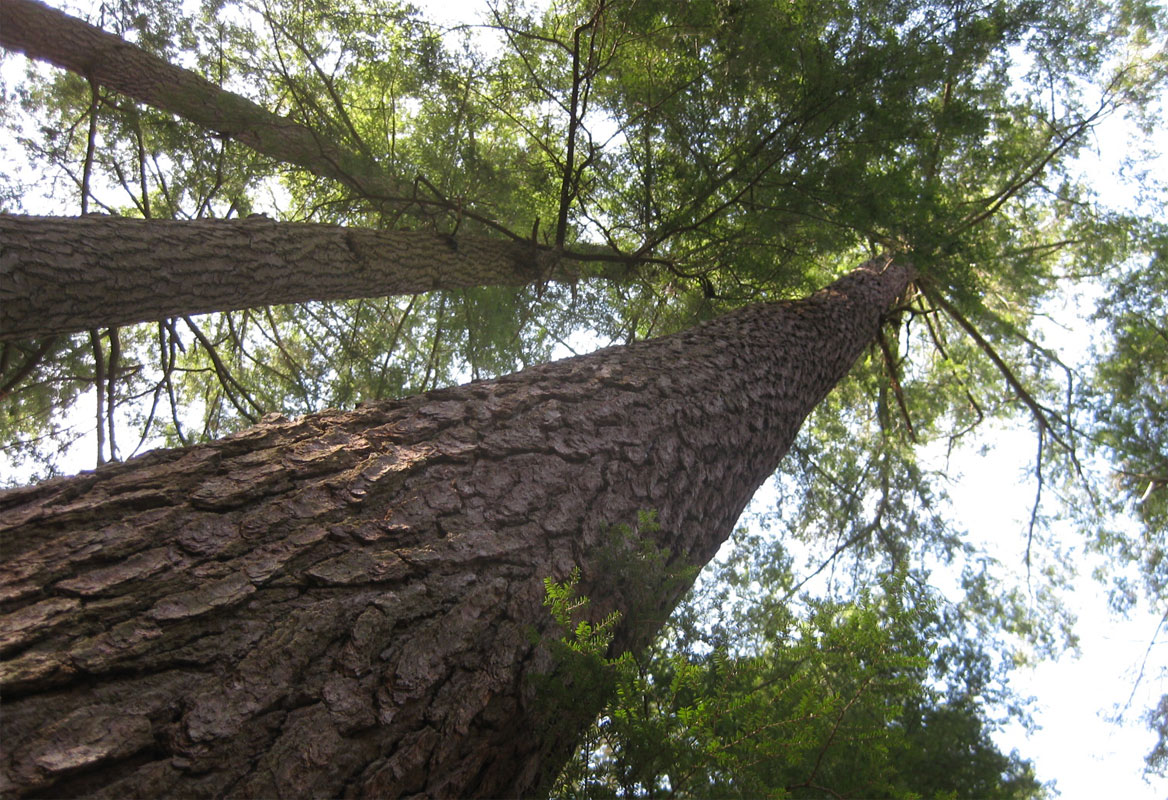
300+ year old White Pine, Hearts Content National Scenic Area

-- Frizbo


Lost among the oil wells and ATV Trails

Tanbark Trail Single Track

  • State: Pennsylvania
  • Date: 2011-05-09 & 2011-05-10
  • Route: Allegheny National Forest (Timberline and Tanbark Trails)
  • Distance: 56 miles

Sunday, May 8, 2011

Ohio, Cuyahoga Valley National Park, Snake Lovers

Waiting for Spring. Waiting for the lake ice to break. Waiting for the tulips to bloom. Waiting for the bike trails to dry. 

Monitoring the national forecast maps for weeks, I hope for a few days of dry weather somewhere in the Midwest so I can continue the Frizbo Fifty. My original plan, a loop through Missouri, Arkansas, and Oklahoma, goes from unlikely to hopeless as first tornadoes, then floods, pummel the southern states. Finally, in early May, there is a break in the relentless rainfall, with clear skies and warm weather in Ohio and Pennsylvania. After my wife generously agrees to my last-minute expedition, I pack the van for a four-day cycling trip to Pennsylvania's Allegheny National Forest.

After an early start and seven hours in the car, I’m ready to stretch my legs. The first stop, just outside Cleveland, is Cuyahoga Valley National Park. Easily accessed from I-80, I park at the Lock 29 Trailhead. As it is Mother's Day, the parking lot is full of parents trailed by their offspring, much like imprinted goslings. I unload my bike, swing onto the Ohio & Erie Towpath Trail, and head north


Ohio & Erie Towpath Trail

A flat limestone trail, interspersed with boardwalks and bridges, the Towpath Trail travels 20 miles along the Cuyahoga River. Other bike trails connect leading north to Cleveland and south as far as Akron. There is even a scenic railroad that will shuttle bikers one way. 

Years ago, the Cuyahoga River was a toxic mess. Serving as an open sewer and dump site for Cleveland's manufacturing sector, the oil-slicked river bubbled like a deadly stew and occasionally burst into flames. A local resident recounted, “The river was a scary little thing, Rats would float by their corpses so bloated they were practically the size of dogs. There was a general rule that if you fell in -- God forbid -- you would go immediately to the hospital."

After the river caught fire in 1969, it galvanized the environmental movement and helped lead to the establishment of the Environmental Protection Agency (EPA) and passage of the Clean Water Act. In 1974, President Ford designated the surrounding area as a national recreation area, and through decades of restoration efforts, the river has been transformed into a vibrant waterway—now popular for fishing, paddling, and serving as the scenic heart of a national park.


Today, I don't see evidence of the former toxicity. All I see are scenic bluffs framing a valley filled with budding spring foliage. As I'm riding, I notice a couple of other bikers approaching in the distance. Suddenly, one of the riders appears to have some sort of fit, wildly swerving his bike and nearly crashing. As they near, I eye him cautiously in case he has another fit. As they pass, I overhear the word "snake." A few moments later, a large snake appears directly in front of my wheel, stretched across the bike path. I violently jerk my handlebars to avoid the snake and nearly crash into the undergrowth.

"Oh, well, that would explain it," I think to myself.

I-80 Bridge

Snakes are a common bike path hazard. On cooler days, and especially in the spring, bike paths are a favorite spot for snakes to warm themselves. Unfortunately, they like to stretch themselves perpendicular to the bike path and pretend to be a stick. Which means I have run over more than a few snakes. I really don't like running over snakes. Not only do I feel terrible for the innocent snake, I've found it's unlucky. Using a reptile as a speed bump often leads to wrong turns, flat tires, and sudden downpours.

When I turn around to see if a snake's OK. I usually find the snake as it was, happily sunning itself, and apparently unharmed. I’ve discussed this with snake experts, whose assessment is that riding over a snake almost certainly causes injury. But, my firsthand experience suggests otherwise. The snakes seem more troubled by my checking on their welfare than by being squashed. After a few moments of me hovering, they quickly slither off the path, seemingly none the worse for wear, and always before I can get a decent photograph.

Bridal Veil Falls

After a few more miles on the flat Towpath Trail, I get distracted and follow a bridle path up Tinkers Creek Gorge, and then to a blacktop trail maintained by the Bedford Park District. Having climbed to the top of the bluffs, I enjoy an exhilarating flight back down to the towpath and the car. 

Spring in Cuyahoga Valley National Park -- a great addition to the Frizbo Fifty and a perfect start to my road trip. 

Next stop, Pennsylvania's Allegheny National Forest.

-- Frizbo

Nice ride, easily accessible from the interstate
  • State: Ohio
  • Date: 2011-05-08
  • Route: Cuyahoga Valley National Park, OH
  • Distance: 32 miles

Wednesday, September 29, 2010

Arizona, South Mountain Park, Pants Hats and Mountain Lions

A business trip to Arizona offered the opportunity for a ride and a chance to check another state off the Frizbo Fifty list. Typically, I plan to arrive the evening before a meeting, but instead I book the earliest flight out of O'Hare and start researching biking possibilities in the Phoenix area.

My first concern is the weather forecast, 105 degrees in Phoenix! I know they say "It's a dry heat," but to a Midwesterner 105 degrees is intimidating. I imagine cramping up 15 miles from the car and wandering the desert wearing a "pants hat."  I learned later that the locals don't get worried until the temperature hits 110 degrees.

I narrow my research down to two bike trips. The first requires a two-hour car drive to Prescott, AZ where the temperatures were expected to be in the 80s or a short drive from the airport to South Mountain Park in Phoenix where the 80s would be the day's low.

At 16,500 acres, Phoenix’s South Mountain Park is the largest municipal park in the world and features over 60 miles of singletrack. After a phone call to the very helpful staff at Cactus Adventures who assured me, yes 105 was warm but my death was unlikely if I drank plenty of fluids, I reserve a mountain bike for 10 a.m. in the morning.

Surprisingly my flight from Chicago is early and soon I am in the rental car and on my way to the bike rental. I make a quick stop for a Subway sandwich and three quarts of Gatorade -- the first of which I chug immediately. "Man, I better get hydrated!" The guys at Cactus Adventures have my 29er ready and give me a trail map, a fill-up on my water bottle, and directions to the trailhead.


"Whew, 105 degrees!"

After a 5-minute bike ride from the bike rental, I bushwhack through a wash and onto the Desert Classic Trail. The heat is intense, but the bike generates just enough of a breeze to keep me cool -- until I get to an uphill. As soon as the path climbs, slowing me down, I feel like I entered a furnace. Fortunately, the Desert Classic Trail is generally level and as I acclimate, I start to really enjoy the ride.

Rented 29er in the Sonoran Desert

I must not have made much of an impression with the rental guys because after only 45 minutes I reach the landmark they suggested as a turn-around point. Too soon to go back. At the top of the ridge is the National Trail but the climb looks really difficult on the map, so I decide to explore the Telegraph Pass Trail which also shows some elevation and see how far I can get. Before long I am carrying the bike up a natural staircase and really feeling the heat.

I am reminded of another desert excursion in the Anza-Borrego Desert a few years back. On that occasion I was hiking by myself on a secluded trail. At the trailhead was an ominous sign warning that all hikers should drink plenty of water. So I start chugging water and continue on my hike. After a half-mile or so there's another sign warning that this is mountain-lion habitat. "If you are approached by a lion, make yourself look big, make loud noises and if attacked, fight back."  So I continue hiking, chugging water and now am continuously scanning the mountainside and boulders for an ambush. By this time I am massively over-hydrated and I need to relieve myself, but that will provide the lion a perfect opportunity for a surprise attack!

Looking back, I obviously overreacted. As it was springtime, the temperatures were relatively mild so I didn't need so much water and if any mountain lion was watching me, they would have been frightened off by the odd behavior of this strange human stopping every quarter mile and peeing in a 360-degree pattern while holding one arm over his head and shouting, "That's right! That's right! I'm BAAAAD!"

Today, the fluids are going pretty quickly. I have already consumed the two quarts of Gatorade in my backpack and am down to my 20 oz. water bottle. I have climbed quite a distance up Telegraph Pass, but it still looks like it may be a long way to the top. I can tell from the map there's a park road at the top of the ridge and from there it's a downhill ride to the ranger station and water, but I'm not sure I can make it. Just at the moment I'm about to give up, I see the roof of a car slide by above the rocks. "That's not so far!" One more push and I'm at the top!


Top of Telegraph Pass, South Mountain Park, AZ

The park road is a smooth two-lane blacktop winding down the mountainside with no traffic. After the climb, coasting with a nice breeze is magical. I glide with barely a turn of the crank down the five miles to the ranger station and right up to the drinking fountain -- no pants hat for me on this trip.


Cooling off on the way down!

The north side of the park offers fewer trails so I take to the roads to link up with the trails on the east side and then down on singletrack to the road back to the bike rental. During the trip I consumed 128 ounces of Gatorade and 104 ounces of water and didn't pee once in four hours (circular or otherwise). Say, it is a dry heat!

-- Frizbo


South Mountain Park Route

  • State: Arizona
  • Date: 2010-09-29
  • Route: South Mountain Park, Phoenix, AZ
  • Distance: 34 miles


Saturday, September 4, 2010

Indiana, Indiana Dunes National Lakeshore, Riptides

On a beautiful day in early September, I drive to the Oak Ridge Prairie County Park near Griffith, Indiana. The county park is the trailhead for the Oak Savannah Trail which runs ten miles west to Hobart. From Hobart, it connects with the Prairie Duneland Trail for another six miles, and then it's a short road ride to the Calumet Trail which runs nine miles along and through the Indiana Dunes National Lakeshore.

Oak Savannah Trail, IN

Northern Indiana is surprisingly well-endowed with bike trails. Griffith also connects to the Erie-Lackawanna Trail and the Chesapeake & Ohio Greenway. The trails are well-marked, but a map is useful to navigate the city streets between trailheads. A young girl in Hobart sees me consulting my paper map and helpfully explains, "The bike trail is by the Dairy Queen!" I imagine the Dairy Queen is the center of her universe, but her hint is not helpful as I have no idea where the Dairy Queen is either.

Calumet Trail, IN

At the end of the Calumet Trail there are a couple of the nicest beaches anywhere. Mount Baldy is a massive living sand dune with beautiful views of Lake Michigan and a steep face perfect for running down. But if you want to avoid carrying a bike up and over sand dunes, go to Central Beach at the end of Central Avenue. It's a short walk from the end of the pavement to the water and Central Beach rarely has the crowds and litter one finds at the nearby state park.


On this day, the sun is out and the wind has pushed the warm surface water to shore so it's a delightful temperature for swimming. The storms from the day before, however, have kicked up the waves -- I mean, they are rocking! -- so despite a sizable crowd at the beach, no one is in the water. With good reason, Lake Michigan can be dangerous on days like this. Riptides can sweep even the strongest swimmers away from shore. Many people mistakenly try to swim against the current, leading to exhaustion and drowning. The trick is to swim parallel to the shore until you are free of the current, then swim back to land.


Central Beach, Indiana Dunes

As I eat my lunch, a group of twenty-somethings come along and immediately head into the water. As I watch them enter the waves I wonder if a riptide sweeps them out to sea, will they know what to do? I contemplate a rescue plan of creating a flotation device by filling my spare inner tube with my portable CO2 pump.

I learned about riptides firsthand during a family vacation to North Carolina in 2006. We were staying at a beach house on the Outer Banks. After a near miss by Tropical Storm Beryl, the sun was out and the surf was up. Looking to test our boogie boarding skills, we scouted the beach for the biggest waves and were really enjoying ourselves when we heard faint cries of "Help! Help!"

At first, we ignored the yelling until we saw a girl swimming in who was obviously upset. I then realized that there were many people out beyond the breakers calling out for help. I told Matt and Lauren to fetch the rest of our floaties (we had quite a collection by then) and I immediately swam out with the raft.

I first came upon a young girl, maybe eleven years old, swimming in while crying. I gave her my raft. Next, I came upon a boy, a few years younger, and attempted to rescue him with a life-saving stroke I learned years earlier in Junior Lifesaving. What worked in a pool thirty years ago proved useless in a real emergency. I realized I couldn't do anything without the raft the girl was swimming away with.

"Wait," I called out. "We need the raft." She hesitated and then kept going. I asked the boy, "What's your sister's name?"

"Michelle," he answered and then we both called, "Michelle, wait!" Finally, she stopped and waited for us -- probably one of the bravest things she's ever done. When I got them both on the raft, the boy turned to me and said, "Please save my dad, he's a really nice guy." The girl just continued to cry.


North Carolina's Outer Banks on a calm day

I looked out to sea and saw just a head bobbing in the big waves well offshore. He was struggling. I knew I couldn't do anything without a raft, so I told the kids we'd have to get him together. They were brave as we paddled back out. As we got closer, I could see his head going under water with each wave. "Hold on one more time! You can do it!" I called out. 

We finally reached him with the raft. As we paddled in, the father said with desperation in his voice, "Don't leave us." When we were within shouting distance of the shore, Mona called out, also with desperation in her voice, "Matt and Lauren are still out in the surf."

"Crap, while I'm saving this family, my own children are drowning," I thought.

It turned out after I left Matt and Lauren at the beach, they had collected the remaining floaties and headed out to do their own rescuing -- Lauren with the River Rat inner tube and Matt with two boogie boards.

As a rescuer swam by Lauren, she offered him the inner tube, "You're a faster swimmer than me." He accepted the raft and later we saw him bring four people back to the beach with it. Moments after giving up the tube, Matt arrived with the extra boogie board for Lauren and that's how I found them -- calmly paddling in on the boogie boards.

Back on the sand, I asked a rescued teenager if they swam out too far. "No," he answered. "We were just pushed out into deep water!" A textbook description of a riptide! A few minutes later the beach patrol arrived. In the end, no one was hurt. If we count the four people on the inner tube, the Frisbies saved seven lives that day.

The Outer Banks sand was too hot for this pampered dog's paws!

Self-congratulations aside, I think the sister and brother probably would have made it back to shore on their own, but the dad was in real trouble. I also learned that you can't save anyone without some kind of flotation device which is why, years later, I find myself contemplating filling my spare inner tube with the portable CO2 pump.

Central Beach, Indiana Dunes

Back at the Indiana Dunes, after fifteen minutes of watching the twenty-somethings have the most amazing time among the waves without being swept away, I strip down to my biker shorts and take the last swim of the summer.

Route

Ride Summary:

    • State: Indiana
    • Date: 2010-09-04
    • Route: Griffin to Indiana Dunes, Central Beach
    • Distance: 60 miles


    Saturday, August 28, 2010

    Illinois, Jo Daviess County, My First Bike Hike

    My sister has been encouraging me to visit her vacation house, a "farmette" in Jo Daviess County, Illinois. Located in the northwest corner of the state, Jo Daviess County is known for its rolling hills and beautiful views -- a perfect spot to begin the "Frizbo Fifty," my epic journey to bike in all 50 states.

    "Tally Gen" -- A farm in Jo Daviess County, IL


    My ride begins in front of my sister's 100-year-old barn. No longer an active farm, the barn's primary purpose is now an arena for my nieces' elaborate custom version of Capture the Flag. From the barn, I ride down the driveway and up the gravel road, heading west toward the Mississippi River.

    Here it's easy to avoid the busy highways as well-packed gravel roads connect the many farms. While not a technical ride, Jo Daviess' roads feature exhilarating descents, long lung-busting climbs and beautiful views throughout.


    My first adventures on a bicycle started at a young age. I grew up as one of the "little kids" in a large Catholic family. While I never felt poor, life within such a large family required certain protocols. For example, every meal was constrained by "the share."

    "What's the share for bacon?" we would ask.

    "Three pieces," my mother would answer. With eight kids (i.e. 168 meals per week) some governance was required. "One glass of orange juice with breakfast, please." "It's two cookies for dessert." "One hamburger each, dear." "If you're still hungry, have some whole-wheat honey toast."

    Christmas and birthdays were no different. For Christmas, we were allowed to ask for anything in the Sears Catalog as long as it was $10 or less. For our birthdays, the gifts were similarly modest with one exception. When we turned seven, we received our own bike. Mine was a brand-new green Schwinn Sting-Ray with coaster brakes, chopper handlebars, and a banana seat, list price $49.95.

    Jo Daviess rolling farm land


    Most of my friends had Sting-Rays too. We spent all summer on our bikes -- me, Gary, Ricky and Eugene ("Genie"). If we weren't riding our bikes, we were playing baseball in the field behind my house (pitcher's hand out, right field is a foul ball). Gary was my age. Ricky and Genie were brothers. Ricky was a year older than me and Genie was a year younger. Despite Ricky being older and bigger than the rest of us, Gary was the leader of our gang. I'm not sure why -- perhaps because he was the fastest runner.

    Under Gary's leadership, I learned how to spit for distance, steal candy from Doretti's Pharmacy and blow a smoke ring. His favorite suggestion was "Let's get in a chase." This typically involved some annoying activity, like throwing rotten apples or snowballs at cars, in the hope that the drivers might try to chase us down. As we knew every alley, fence, empty lot, and backyard in the neighborhood, we could disappear in a moment. Fleeing, we would hide underneath some porch breathlessly stifling laughs and then freezing in fright at every sound.

    On summer evenings, we used the gathering dusk to play games on passing cars. One trick was for two groups of kids to stand on opposite sides of the street and pretend to play a game of tug-of-war across the street. Drivers would approach and slow looking for the non-existent rope. If they came to a complete stop, we would fall to the ground in laughter.

    One friend perfected a gag of running into a stop sign. We would pretend to play football and when in full view of an approaching car, he would accidentally smash his face into the sign with a horrible impact. In actuality, he would strike the sign with his hand with a loud crash and fall to the ground writhing in mock pain. When the alarmed driver got out to see if they could help, he would jump up, laugh, and run away. When done well, it really was hilarious. I can only imagine the driver's story when they got home.

    Sometime during the summer after second grade, Gary suggested we go on a "bike hike" to Deer Grove Forest Preserve. Deer Grove was a couple towns away, and we only had a vague idea of the route, but we agreed it was an excellent idea. It seems surprising now that four boys, ages 7-9, would be allowed to attempt such an expedition, but those were different times, and I'm not sure we asked permission.

    We set off on our Sting-Rays and made it as far as Palatine. After wandering up and down the gravel shoulder of Northwest Highway looking for Quentin Road, we gave up and rode back home. Undeterred, a week later we tried again. This time we were able to find our way. We also came prepared with hot dogs for lunch and some fishing gear. We spent the afternoon fishing next to a culvert and discovered that crayfish are very fond of hot dogs.


    We also discovered that Sting-Rays are fantastic for off-road riding. Along the gullies cut by Salt Creek were a maze of trails perfect for the small wheels and low-gear ratios of the Sting-Ray. After that day, we often rode to Deer Grove, fishing in the pond, wading in the waterfall, and riding the trails on our Sting-Rays.

    Many decades later, I still ride to Deer Grove, but now I follow the paved bike paths. Sadly, the popularity and subsequent damage of mountain biking forced the closure of the Salt Creek gullies to off-trail riding. I wonder if I could get dispensation from the closures if I rode those trails on a Sting-Ray.

    Mighty Mississippi


    Back in Jo Daviess County, I discover a backdoor jeep trail into Mississippi Palisades State Park and find myself overlooking the mighty Mississippi River. This is a great start to the Frizbo Fifty.


    Blog update: My sister showed me this note 13 years later. I found it very gratifying that she believed in me to enough save the historical artifact.


    --Frizbo
    • State: Illinois
    • Date: 2010-08-28
    • Route: IL-78 to Mississippi Palisades State Park
    • Distance: 50 miles

    Saturday, August 21, 2010

    Why the Frizbo Fifty?

    Last week, I dropped my daughter off at the University of Illinois, where she will begin life as a freshman and my wife and I will begin life as "empty nesters." This was not my only milestone this year. In March, I celebrated my 50th birthday. At the time, I contemplated ways to mark the passing of 50 years: drink 50 beers, call 50 old friends, spend $50K on a new car, but the summer was busy and nothing was done. Now, with the summer over and the kids off to school, I really am peering over the precipice. What will I do with the rest of my life? It must be something that gives me a long-term goal, something that's inspirational and aspirational, something that gets me out of the house, and something with a 50 in it.


    A new (unofficial) bike route starting from my driveway

    The epic journey has always appealed to me: spend a summer hiking the Appalachian Trail or sail solo around the world and then write a book about it*. Having read many of these books, I’ve learned that epic journeys have some downsides.

    First and foremost is the need to take time off for your epic journey. Who can afford to take the summer off to rollerblade around Lake Superior with two kids in college? A common solution for Appalachian Trail hikers is to "section hike" the AT by taking off a week or two each year to hike a section of trail -- picking up where you left off until you have traveled the entire distance from Georgia to Maine. Admittedly, this approach is not quite as impressive as doing it in one go, but it's still somewhat "epic."

    Second is logistics. Ernest Shackleton, the godfather of epic journeys, spent years preparing for his expeditions to the South Pole. Two actors who motorcycled from Scotland to Cape Town needed a couple of supply trucks following them. For me, such logistical requirements are not practical or even feasible.

    The third downside is the "bad stretches." Any kind of long-distance journey includes parts of the trail that, frankly, suck. A cross-country cyclist discovered that the only road through a mountain pass had no shoulder and was the route preferred by truckers. One epic journey book author, boating from New York to the Pacific Ocean, described the stretch of canoeing the upper Missouri by simply repeating the word "river" for five pages. "River, river, river, river, river, river, river, river, river, river, river, river, mud flat, river, river, river, river..." Do you really want to forgo your summer so you can bike in 100-degree heat through the endless wheat fields of Nebraska? Wouldn't it be better to cherry-pick the best parts.

    After much thought, my proposed epic journey is the "Frizbo Fifty." The goal is to bicycle in every one of the 50 states of the United States of America before I celebrate my 60th birthday**. The rules are I must bike at least 10 miles in each state and the total number of miles must be 2,800 miles (the distance between New York City and San Diego)***. To accomplish this, I will need to bike five states a year and average 56 miles per state -- totally doable.

    The Frizbo Fifty is by definition section hiking. Periodically, I will take a week or weekend off for the "epic journey", returning before my inbox overflows. Logistically, I just need to throw the bike on the car-top carrier, the camping gear in the back, and I'm off. Living in Chicago means much of the country is within a two-day drive. And the best part is, every state has at least one really nice biking trail.

    -- Patrick Frisbie (aka Frizbo)

    *Epic Journey Books:
    • "A Walk in the Woods" -- very funny!
    • "Long Way Down" -- dreadful.
    • "River-Horse: The Logbook of a Boat Across America" -- thoughtful, inspirational.
    • "The Endurance" -- Shackleton! Say no more.
    **Covid-19 Amendment -- since the pandemic shutdown travel, biking and my 60th birthday party, I am deferring the official celebration of my 60th birthday until I can get on a plane for Hawaii.

    ***I've realized I don't want the Frizbo Fifty to end too soon, so I've extended the mileage to 5,000 miles.